Area Overview for Long Eaton Central Ward
Photos of Long Eaton Central Ward


Area Information
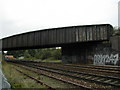
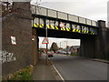
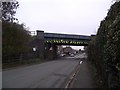
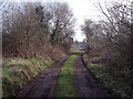
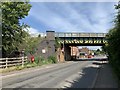
Long Eaton Central Ward forms the heart of the town of Long Eaton within the Erewash borough council. This district sits just north of the River Trent, approximately 6 miles south-west of Nottingham and 9 miles south-east of Derby. The ward covers a specific area of 1.9 km², containing a recorded population of 1,534 people. Residents here enjoy a lifestyle defined by proximity to major infrastructure, including the Midland Main Line which passes directly through the area. East Midlands Railway services connect you to London St Pancras, Sheffield, and Birmingham New Street, while bus links reach East Midlands Airport and Derby. The A6005 runs through the town, placing M1 Junction 25 on your north-western border. Living in Long Eaton Central Ward means you are located in the East Midlands region, situated at coordinates 52.8898°N, -1.2711°W. Daily life involves navigating a compact urban environment where transport hubs are immediate neighbours to residential zones. You will find yourself surrounded by a community that benefits from extensive rail and road networks designed for regional connectivity. The ward acts as a central node, allowing easy access to wider destinations without the need to travel far beyond the town boundary. This location defines your daily commute patterns and your general reach into the Midlands transport web.
- Area Type
- District Borough Unitary Ward
- Area Size
- 1.9 km²
- Population
- 1534
- Population Density
- 826 people/km²
Demographics
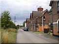
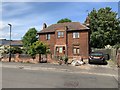
The community within Long Eaton Central Ward reflects a distinct older population profile. The median age for residents stands at 70 years, indicating a predominantly mature demographic. Age is recorded as the total most common category, suggesting a wide distribution beyond the median but skewed towards older groups. You will encounter a stable population structure rather than a transient young workforce. Home ownership rates are significant, with 60% of households in Long Eaton Central Ward owning their property. This high ownership level suggests a residential area where long-term residents have settled rather than a high-turnover rental market. Most household compositions fall under the total category, encompassing various family structures typical of retiring populations or established couples. Accommodation types similarly record as total, implying a mix of dwelling styles suitable for different needs. The ward maintains a balanced ethnic distribution across the total population, with no single group dominating the demographic landscape. Religion data covers the total population, reflecting a mix of beliefs common in established British communities. This demographic makeup creates a neighbourhood where stability is the norm and quality of life is measured by local amenities designed for an older demographic.
Household Size
Accommodation Type
Tenure
Ethnic Group
Religion
Household Composition
Age
Household Deprivation
NS-SEC
Explore more demographic insights in this area
Go to Demographics tabPlanning
Planning Constraints
- Flood RiskPremium
- Ramsar Wetland SitesPremium
- Area of Outstanding Natural BeautyPremium
- Protected Nature ReservePremium
- Protected WoodlandPremium
- Crime RiskPremium