Area Overview for Long Clawson and Stathern Ward
Photos of Long Clawson and Stathern Ward

Area Information
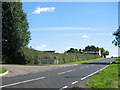
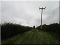
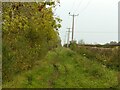
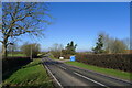
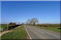
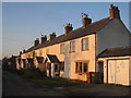
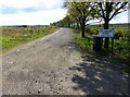
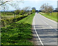
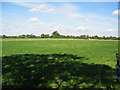
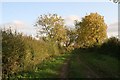
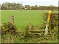
Long Clawson and Stathern Ward is a rural electoral ward in Melton Borough, Leicestershire, covering an area of 60.3 km². This district encompasses the village of Long Clawson in the Vale of Belvoir and the nearby settlement of Stathern. Long Clawson is a linear village stretching over a mile along a winding main road with 14 sharp bends. The surrounding landscape is dominated by farmland ideal for pasture, establishing a distinct agricultural character for the region. The ware was listed in the Domesday Book of 1086 as Clachestone, indicating a long history of habitation in this corner of the East Midlands. You will find a mix of historic and newer properties amid the farmland, with around 100 new houses constructed in the early 21st century to accommodate a growing population. Key landmarks include the Grade II* listed Manor Farmhouse, a late 16th-century former rectory, and the Grade II listed Crown & Plough pub, which dates to 1730. The Church of St Remigius and a scheduled moated castle site also define the physical landscape. Daily life here revolves around the village green and The Sands, which serves as a social hub containing shops, a pharmacy, and a surgery. However, the local business environment has seen contraction, evidenced by the fact that the village once supported five pubs before declining to one operating establishment. Living in Long Clawson and Stathern Ward means accessing a community with deep historical roots while navigating a rural economy driven largely by the dairy sector and Stilton cheese production. You can expect a quiet existence surrounded by open countryside, far from the intensity of urban life.
- Area Type
- District Borough Unitary Ward
- Area Size
- 60.3 km²
- Population
- Not available
- Population Density
- Not available
Demographics
The community profile for Long Clawson and Stathern Ward shows a population heavily weighted towards older residents. The median age is 70, making this one of the oldest-electoral districts in the country. Age: Total is the most common age range recorded in the census data, though the high median indicates a significant concentration of elderly homeowners. This demographic structure contrasts sharply with urban centres that often attract young professionals or families seeking immediate access to employment hubs. Home ownership stands at 78% in the ward, reflecting a settled population rather than a transient workforce. This high rate of ownership suggests that many residents have stayed in the area for decades, building deep local roots. The data indicates that the household composition is dominated by total households without specific breakdowns into single-person or multi-generational units, but the age profile strongly implies a prevalence of smaller, older households. Accommodation types are not specified in the available records, but the construction of 100 new houses in the early 2000s suggests an effort to modernise the housing stock for an expanding population. These statistics point to a stable environment where long-term residents form the core of the social fabric. With a median age of 70, the local services and amenities likely cater to an older demographic, including the surgery and pharmacy found at The Sands. Living in Long Clawson and Stathern Ward requires acceptance of a slower pace of life suited to retirees and those seeking peace, rather than the dynamic environments found in major cities.
Household Size
Accommodation Type
Tenure
Ethnic Group
Religion
Household Composition
Age
Household Deprivation
NS-SEC
Explore more demographic insights in this area
Go to Demographics tabPlanning
Planning Constraints
- Flood RiskPremium
- Ramsar Wetland SitesPremium
- Area of Outstanding Natural BeautyPremium
- Protected Nature ReservePremium
- Protected WoodlandPremium
- Crime RiskPremium