Area Overview for Londonthorpe and Harrowby Without
Photos of Londonthorpe and Harrowby Without


Area Information
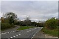
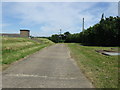
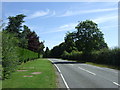
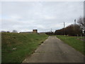
Londonthorpe and Harrowby Without stands as a civil parish covering an area of 15.7 km² in England. Living here offers a distinctly rural experience defined by its small footprint and quiet character. The locality functions as a self-contained community rather than an extension of a larger town, ensuring that daily life moves at a deliberate pace. You will find that the environment is mature and established, catering specifically to those who prefer stability over rapid development. The parish provides a clear separation from noisier or more densely populated centres, making it an ideal backdrop for a grounded lifestyle. The administrative status as a civil parish means there is a degree of formal recognition for the local governance and community identity. This structure supports a tight-knit social fabric where neighbours often know one another. When you consider homes in Londonthorpe and Harrowby Without, you are entering a space where the layout and boundaries are well understood by residents. The total area size of 15.7 km² limits the sprawl, meaning that distances between homes and local amenities are generally manageable. This compactness fosters a sense of belonging without the inconvenience of urban congestion or the isolation of remote countryside locations.
- Area Type
- Parish
- Area Size
- 15.7 km²
- Population
- Not available
- Population Density
- Not available
Demographics
The community in Londonthorpe and Harrowby Without reflects a significant demographic shift towards an older population. The median age stands at 70, indicating that you are more likely to meet retirees or older residents than young families in the traditional sense. This age profile shapes the demand for single-level housing and ease of access throughout the parish. In terms of household composition, the data confirms a mature society where large families are less common and empty nesters or widow/husband households play a prominent role. Home ownership is established as the norm within the area, with 73% of homes owned outright or with a mortgage. This high rate suggests financial stability among residents and a deep local investment in property values. You will find that the accommodation stock mirrors this ownership trend, with fewer private rentals available compared to urban surbans. The diversity data points to a predominantly white population, which aligns with the quiet, traditional nature of the parish. There is no significant concentration of other ethnic groups according to the available records, further cementing the area's homogeneous character. Religion and specific ethnic breakdowns are not detailed in the current profile, but the overall picture remains one of a settled, older community where loyalty to home runs high.
Household Size
Accommodation Type
Tenure
Ethnic Group
Religion
Household Composition
Age
Household Deprivation
NS-SEC
Explore more demographic insights in this area
Go to Demographics tabPlanning
Planning Constraints
- Flood RiskLocked
- Ramsar Wetland SitesLocked
- Area of Outstanding Natural BeautyLocked
- Protected Nature ReserveLocked
- Protected WoodlandLocked
- Crime RiskLocked