Area Overview for LN9 6QF
Photos of LN9 6QF
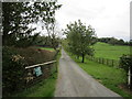
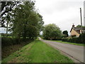
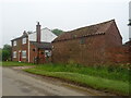
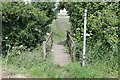
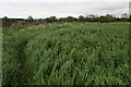
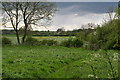
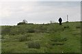
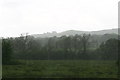
20 photos from this area
Area Information
Key information about the LN9 6QF including its size, population, and administrative classification.
- Area Type
- Postcode
- Area Size
- 1.8 km²
- Population
- 2181
- Population Density
- 19 people/km²
House Prices in LN9 6QF
16
Properties
£276,800
Average Sold Price
£106,500
Lowest Price
£477,500
Highest Price
Showing 16 properties
| Address | Type | Beds | Baths | Last Sale Price | Last Sale Date | |
|---|---|---|---|---|---|---|
| Badgers Holt, South Ormsby Road, Tetford, LN9 6QF | house | - | - | £345,000 | Nov 2021 | |
| Grayfield House, South Ormsby Road, Tetford, LN9 6QF | Land | - | - | £477,500 | May 2021 | |
| Tumpers Cote, South Ormsby Road, Tetford, LN9 6QF | Cottage | 3 | 1 | £245,000 | Feb 2015 | |
| Parham Cottage, South Ormsby Road, Tetford, LN9 6QF | house | - | - | £210,000 | Jan 2012 | |
| Clough Farm Cottage, South Ormsby Road, Tetford, LN9 6QF | Detached | - | - | £106,500 | Apr 1998 | |
| Spinney Hill, South Ormsby Road, Tetford, LN9 6QF | house | 5 | 3 | - | - | |
| Walnut Cottage, South Ormsby Road, Tetford, LN9 6QF | Detached | 4 | - | - | - | |
| Highlander Farm, South Ormsby Road, Tetford, LN9 6QF | house | 4 | 2 | - | - | |
| Newhaven, South Ormsby Road, Tetford, LN9 6QF | commercial | - | - | - | - | |
| Flat At, Abbotts Gardens, South Ormsby Road, Tetford, LN9 6QF | Flat | - | - | - | - |
Page 1 of 2
Energy Efficiency in LN9 6QF
Amenities
Schools
| Rank | School | Type | Entry gender | Ages |
|---|
Explore more schools in this area
Go to Schools tabDemographics
Household Size
Two person
most common
Accommodation Type
Houses
most common
Tenure
79
majority
Ethnic Group
White
most common
Religion
N/A
most common
Household Composition
N/A
most common
Age
47
median
Adults (30-64 years)
most common
Household Deprivation
N/A
with no deprivation
NS-SEC
36
in Lower managerial occupations
Explore more demographic insights in this area
Go to Demographics tabPlanning
Planning Constraints
- Flood RiskPremium
- Ramsar Wetland SitesPremium
- Area of Outstanding Natural BeautyPremium
- Protected Nature ReservePremium
- Protected WoodlandPremium