Area Overview for LN9 5NE
Photos of LN9 5NE

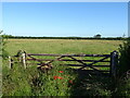
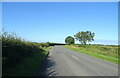
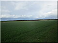
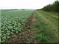

12 photos from this area
Area Information
Key information about the LN9 5NE including its size, population, and administrative classification.
- Area Type
- Postcode
- Area Size
- 4.3 km²
- Population
- 2365
- Population Density
- 19 people/km²
House Prices in LN9 5NE
13
Properties
£360,747
Average Sold Price
£96,586
Lowest Price
£760,000
Highest Price
Showing 13 properties
| Address | Type | Beds | Baths | Last Sale Price | Last Sale Date | |
|---|---|---|---|---|---|---|
| Limes Farm Cottage, Bardney Road, Baumber, LN9 5NE | Detached | - | - | £369,900 | Mar 2023 | |
| Vicarage View, Bardney Road, Baumber, LN9 5NE | house | - | - | £216,500 | May 2021 | |
| The Limes, Bardney Road, Baumber, LN9 5NE | Detached | 5 | 3 | £760,000 | Mar 2021 | |
| Four Seasons, Bardney Road, Baumber, LN9 5NE | house | - | - | £96,586 | Nov 2007 | |
| 1, Chase Farm Cottages, Bardney Road, Baumber, LN9 5NE | Semi-detached | - | - | - | - | |
| The Chase, Bardney Road, Baumber, LN9 5NE | Semi-detached | 1 | 1 | - | - | |
| 2, Chase Farm Cottages, Bardney Road, Baumber, LN9 5NE | Semi-detached | - | - | - | - | |
| T B Harrison & Sons Ltd, Park Farm, Bardney Road, Baumber, LN9 5NE | Farm | - | - | - | - | |
| Bowser & Ward, Bowser And Ward, The Chase, Bardney Road, Baumber, LN9 5NE | Farm | - | - | - | - | |
| Tennis 45M From The Chase 44M From Unnamed Road, Bardney Road, Baumber, LN9 5NE | Leisure | - | - | - | - |
Page 1 of 2
Energy Efficiency in LN9 5NE
Amenities
Schools
| Rank | School | Type | Entry gender | Ages |
|---|
Explore more schools in this area
Go to Schools tabDemographics
Household Size
Two person
most common
Accommodation Type
Houses
most common
Tenure
84
majority
Ethnic Group
White
most common
Religion
N/A
most common
Household Composition
N/A
most common
Age
47
median
Adults (30-64 years)
most common
Household Deprivation
N/A
with no deprivation
NS-SEC
30
in Lower managerial occupations
Explore more demographic insights in this area
Go to Demographics tabPlanning
Planning Constraints
- Flood RiskPremium
- Ramsar Wetland SitesPremium
- Area of Outstanding Natural BeautyPremium
- Protected Nature ReservePremium
- Protected WoodlandPremium