Area Overview for LN8 6HP
Photos of LN8 6HP

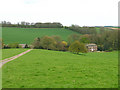
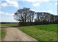
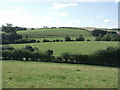
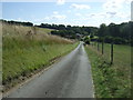
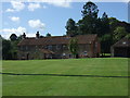

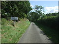

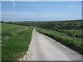
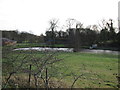
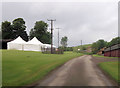
35 photos from this area
Area Information
Key information about the LN8 6HP including its size, population, and administrative classification.
- Area Type
- Postcode
- Area Size
- 8.4 km²
- Population
- 1091
- Population Density
- 23 people/km²
House Prices in LN8 6HP
26
Properties
£270,667
Average Sold Price
£187,000
Lowest Price
£365,000
Highest Price
Showing 26 properties
| Address | Type | Beds | Baths | Last Sale Price | Last Sale Date | |
|---|---|---|---|---|---|---|
| Hillside, Walesby Lane, Stainton Le Vale, Market Rasen, LN8 6HP | Bungalow | 3 | - | £260,000 | Dec 2015 | |
| Pebbles, South Lane, Stainton Le Vale, Market Rasen, LN8 6HP | Detached | 4 | 2 | £187,000 | Nov 2002 | |
| Mole End, Walesby Lane, Stainton Le Vale, Market Rasen, LN8 6HP | Detached | - | - | £365,000 | Jul 2001 | |
| The Old Rectory, Rectory Lane, Stainton Le Vale, Market Rasen, LN8 6HP | Detached | 4 | 4 | - | - | |
| Fourways, Walesby Lane, Stainton Le Vale, Market Rasen, LN8 6HP | Detached | 3 | 2 | - | - | |
| Old School House, South Lane, Stainton Le Vale, Market Rasen, LN8 6HP | Cottage | 3 | 1 | - | - | |
| 2, Brookfield Close, South Lane, Stainton Le Vale, Market Rasen, LN8 6HP | Semi-detached | 3 | 1 | - | - | |
| Stone House, Greenbanks, South Lane, Stainton Le Vale, Market Rasen, LN8 6HP | house | 5 | 2 | - | - | |
| Stainton Hall, Rectory Lane, Stainton Le Vale, Market Rasen, LN8 6HP | Bungalow | 3 | 2 | - | - | |
| Stainton Village Hall, South Lane, Stainton Le Vale, Market Rasen, LN8 6HP | commercial | - | - | - | - |
Page 1 of 3
Energy Efficiency in LN8 6HP
Amenities
Schools
| Rank | School | Type | Entry gender | Ages |
|---|
Explore more schools in this area
Go to Schools tabDemographics
Household Size
Two person
most common
Accommodation Type
Houses
most common
Tenure
65
majority
Ethnic Group
White
most common
Religion
N/A
most common
Household Composition
N/A
most common
Age
47
median
Adults (30-64 years)
most common
Household Deprivation
N/A
with no deprivation
NS-SEC
25
in Lower managerial occupations
Explore more demographic insights in this area
Go to Demographics tabPlanning
Planning Constraints
- Flood RiskPremium
- Ramsar Wetland SitesPremium
- Area of Outstanding Natural BeautyPremium
- Protected Nature ReservePremium
- Protected WoodlandPremium