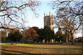
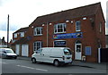
Area Overview for LN8 5WA
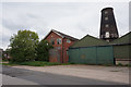
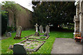
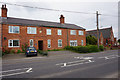
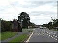
Photos of LN8 5WA
Area Information
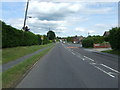
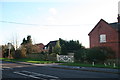
LN8 5WA is a small, tightly knit residential area in England, home to 2,591 people spread across a low-density landscape of 57 people per square kilometre. This modest size suggests a quiet, community-focused environment where familiarity with neighbours is likely. The area’s demographic profile skews towards adults aged 30–64, with a median age of 47, indicating a stable population of homeowners and long-term residents. With 72% of properties owned by occupants, the area leans towards family homes rather than rental properties, contributing to a sense of permanence. Proximity to Wragby Primary School, rated good by Ofsted, adds to the appeal for families. The low flood risk and below-average crime rate, scoring 74 on a 100-point scale, further reinforce its safety. While the broadband score is poor at 28, mobile coverage is strong, offering flexibility for remote work. This blend of stability, safety, and essential services makes LN8 5WA a practical choice for those seeking a low-maintenance, family-oriented lifestyle.
- Area Type
- Postcode
- Area Size
- Not available
- Population
- 2591
- Population Density
- 57 people/km²
LN8 5WA is a predominantly owner-occupied area, with 72% of properties owned by their occupants. The housing stock is largely composed of houses, which suggests a focus on family homes and a lack of high-density developments. This aligns with the area’s demographic profile of older, settled residents. The small population and limited housing stock indicate a niche market, where buyers may need to consider nearby areas for additional options. The high home ownership rate implies a stable property market with fewer rental properties, potentially reducing competition for buyers. However, the low population density also means that the area’s housing supply is limited, which could affect property values and availability. For those seeking a quiet, family-oriented home, LN8 5WA offers a straightforward market with minimal turnover.
House Prices in LN8 5WA
No properties found in this postcode.
Energy Efficiency in LN8 5WA
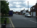
The nearest amenities to LN8 5WA include two retail outlets, both operated by Lincolnshire Co-operative Co. These provide essential shopping services, though the variety is limited to basic retail. The absence of other amenities like dining venues, parks, or leisure facilities suggests a minimal lifestyle offering, focused on practical needs rather than recreational options. This simplicity aligns with the area’s low population density and quiet, residential character. While the shops offer convenience for daily errands, residents may need to travel further for more diverse leisure or dining experiences. The lack of detailed data on parks or public spaces means the area’s recreational opportunities are inferred to be limited, reinforcing a lifestyle that prioritises practicality over extensive amenities.
Amenities
Schools
The nearest school to LN8 5WA is Wragby Primary School, which serves the local community with a good Ofsted rating. As a primary school, it caters to younger children, making it a key consideration for families with school-age dependents. The absence of secondary schools in the immediate vicinity means families may need to look further afield for comprehensive education. However, the quality of the primary school suggests a commitment to educational standards in the area. The single school listed reflects the small size of LN8 5WA, where educational needs are met at the primary level but may require additional planning for secondary education. This dynamic could influence decisions for families prioritising proximity to schools.
| Rank | School | Type | Entry gender | Ages |
|---|---|---|---|---|
| 1 | Wragby Primary School | primary | N/A | N/A |
Explore more schools in this area
Go to Schools tabDemographics
The population of LN8 5WA is predominantly adults aged 30–64, with a median age of 47. This suggests a mature, established community where most residents are likely to be homeowners. Home ownership stands at 72%, reflecting a strong preference for long-term residency over rental properties. The area is composed mainly of houses, which aligns with the demographic profile of older, settled households. The predominant ethnic group is White, and while specific data on diversity is not provided, the population density of 57 people per square kilometre indicates a sparse, low-pressure living environment. This combination of factors—older residents, high home ownership, and a focus on single-family homes—creates a community that prioritises stability over transient living. The absence of detailed deprivation data means the area’s quality of life is inferred from its safety and amenities, such as the nearby primary school.
Household Size
Accommodation Type
Tenure
Ethnic Group
Religion
Household Composition
Age
Household Deprivation
NS-SEC
Explore more demographic insights in this area
Go to Demographics tabPlanning
Planning Constraints
- Flood RiskPremium
- Ramsar Wetland SitesPremium
- Area of Outstanding Natural BeautyPremium
- Protected Nature ReservePremium
- Protected WoodlandPremium
- Crime RiskPremium