Area Overview for LN7 6LJ
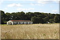
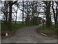
Photos of LN7 6LJ


Area Information
Living in LN7 6LJ offers a compact, residential experience shaped by its small cluster of homes and proximity to essential services. With a population of 1,966 spread across 491 people per square kilometre, this area balances density with a sense of community. The postcode covers a tight-knit neighbourhood where daily life is influenced by nearby amenities and transport links. While not a sprawling suburb, LN7 6LJ provides access to local shops, schools, and rail stations, making it practical for those who prioritise convenience. The area’s character is defined by its mix of older housing stock and proximity to regional infrastructure, such as Humberside Airport and Lincolnshire’s rail network. For buyers seeking a quieter, less congested environment, LN7 6LJ’s low population density and limited urban sprawl could appeal. However, its size means it is best suited for those who value proximity to larger towns or cities for broader opportunities. The area’s distinctiveness lies in its balance between residential tranquillity and functional connectivity, offering a snapshot of rural England with a touch of modern accessibility.
- Area Type
- Postcode
- Area Size
- Not available
- Population
- 1966
- Population Density
- 491 people/km²
The property market in LN7 6LJ is dominated by owner-occupied homes, with 79% of residents living in properties they own. This contrasts with areas where rental markets dominate, suggesting a focus on long-term residency rather than speculative investment. The accommodation type is exclusively houses, which may indicate a preference for larger, more private living spaces compared to flats or apartments. Given the area’s small size, the housing stock is likely limited, meaning buyers may need to consider nearby regions for additional options. The high home ownership rate also implies that properties here are often family homes, potentially with lower turnover rates. For buyers, this could mean a competitive market with fewer listings, though the emphasis on houses may appeal to those seeking space and privacy. The compact nature of LN7 6LJ also means that proximity to amenities and transport links is a key factor in property value, as residents rely on nearby services rather than in-house facilities.
House Prices in LN7 6LJ
No properties found in this postcode.
Energy Efficiency in LN7 6LJ
The lifestyle in LN7 6LJ is shaped by its proximity to essential amenities, including three retail outlets such as Lincolnshire Co-operative Co and Morrisons Daily. These shops provide access to groceries, household goods, and other necessities, reducing the need for long trips to larger centres. The presence of two rail stations—Barnetby and Brigg—adds to the area’s connectivity, enabling residents to travel to nearby towns for work, leisure, or socialising. While the data does not mention parks or leisure facilities, the absence of protected natural areas or planning constraints suggests that open spaces may be limited. The area’s compact nature means that daily life revolves around local services and nearby transport hubs. For those who enjoy convenience over expansive recreational options, LN7 6LJ offers a practical, no-frills lifestyle. The mix of retail and transport links ensures that residents can meet most of their needs without venturing far, though those seeking extensive green spaces or cultural amenities may need to look beyond the immediate area.
Amenities
Schools
Residents of LN7 6LJ have access to Caistor Grammar School, which operates as both a primary school and an academy with a good Ofsted rating. The presence of a primary school within the area ensures that younger children can attend local education without long commutes. The academy status of the secondary provision suggests a focus on academic standards and potentially broader curricular offerings. While only one school is explicitly named in the data, the dual role of Caistor Grammar School implies that families have access to both early years education and secondary schooling in a single institution. This could be beneficial for parents seeking continuity in their children’s education, though it may also mean limited choice compared to areas with multiple schools. The good Ofsted rating indicates that the school meets or exceeds national standards, which is a positive factor for families prioritising educational quality.
| Rank | School | Type | Entry gender | Ages |
|---|
Explore more schools in this area
Go to Schools tabDemographics
The community in LN7 6LJ is predominantly composed of adults aged 30–64, with a median age of 47. This suggests a population skewed towards middle-aged residents, many of whom may be in their peak working years or nearing retirement. Home ownership is high at 79%, indicating a stable, long-term resident base rather than a transient rental market. The accommodation type is primarily houses, which aligns with the demographic profile of older, family-oriented households. The predominant ethnic group is White, though no specific data on diversity or minority representation is provided. The age profile and ownership figures suggest a community with established roots, where property is likely viewed as an investment rather than a short-term asset. The absence of detailed deprivation data means the area’s socioeconomic challenges cannot be fully assessed, but the high home ownership rate and median age imply a relatively secure financial position for most residents.
Household Size
Accommodation Type
Tenure
Ethnic Group
Religion
Household Composition
Age
Household Deprivation
NS-SEC
Explore more demographic insights in this area
Go to Demographics tabPlanning
Planning Constraints
- Flood RiskPremium
- Ramsar Wetland SitesPremium
- Area of Outstanding Natural BeautyPremium
- Protected Nature ReservePremium
- Protected WoodlandPremium