Area Overview for LN6 9LE
Photos of LN6 9LE


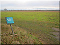
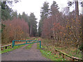


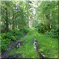
20 photos from this area
Area Information
Key information about the LN6 9LE including its size, population, and administrative classification.
- Area Type
- Postcode
- Area Size
- 2.3 km²
- Population
- 1241
- Population Density
- 37 people/km²
House Prices in LN6 9LE
11
Properties
£371,250
Average Sold Price
£86,000
Lowest Price
£700,000
Highest Price
Showing 11 properties
| Address | Type | Beds | Baths | Last Sale Price | Last Sale Date | |
|---|---|---|---|---|---|---|
| The Wood House, Coddington Lane, Stapleford, Lincoln, LN6 9LE | Detached | 3 | - | £385,000 | Nov 2017 | |
| 1, Trinity Cottages, Coddington Lane, Stapleford, Lincoln, LN6 9LE | house | - | - | £314,000 | Jan 2012 | |
| Moor Farm, Coddington Lane, Stapleford, Lincoln, LN6 9LE | Detached | - | - | £700,000 | Jul 2010 | |
| 2, Trinity Cottages, Coddington Lane, Stapleford, Lincoln, LN6 9LE | Semi-detached | - | - | £86,000 | Nov 1998 | |
| Stapleford House Farm, Lodge Drive, Stapleford, Lincoln, LN6 9LE | Detached | 3 | 1 | - | - | |
| Stapelford Grange, Grange Drive, Stapleford, Lincoln, LN6 9LE | Detached | - | - | - | - | |
| C F Construction Collingham Ltd, Moor Farm Workshop, Coddington Lane, Stapleford, Lincoln, LN6 9LE | Industrial | - | - | - | - | |
| Stapleford House Farm Cottage, Lodge Drive, Stapleford, Lincoln, LN6 9LE | Detached | - | - | - | - | |
| Moor Farm House, Coddington Lane, Stapleford, Lincoln, LN6 9LE | Terraced | - | - | - | - | |
| Moor Farm Barn, Coddington Lane, Stapleford, Lincoln, LN6 9LE | house | - | - | - | - |
Page 1 of 2
Energy Efficiency in LN6 9LE
Amenities
Schools
| Rank | School | Type | Entry gender | Ages |
|---|
Explore more schools in this area
Go to Schools tabDemographics
Household Size
Two person
most common
Accommodation Type
Houses
most common
Tenure
81
majority
Ethnic Group
White
most common
Religion
N/A
most common
Household Composition
N/A
most common
Age
47
median
Adults (30-64 years)
most common
Household Deprivation
N/A
with no deprivation
NS-SEC
41
in Lower managerial occupations
Explore more demographic insights in this area
Go to Demographics tabPlanning
Planning Constraints
- Flood RiskPremium
- Ramsar Wetland SitesPremium
- Area of Outstanding Natural BeautyPremium
- Protected Nature ReservePremium
- Protected WoodlandPremium