Area Overview for LN6 9GU
Photos of LN6 9GU
Area Information
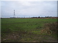
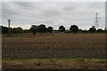
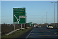
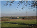
LN6 9GU is a small, tightly knit residential area in England, covering just 4.3 hectares and home to 2,588 residents. Its compact size means it feels intimate, with a population density of 54 people per square kilometre. This is a community of mostly older adults, with the median age at 47 and the majority of residents falling between 30 and 64 years old. The area’s low flood risk and below-average crime rate, with a safety score of 74, make it appealing for families seeking stability. Daily life here is shaped by its proximity to local schools, railway stations, and a mix of small retail outlets. While the area lacks large-scale amenities, its practical connectivity to nearby towns via rail and its proximity to RAF Waddington offer a balance of convenience and quiet living. The absence of environmental constraints like protected woodlands or Areas of Outstanding Natural Beauty means development is unencumbered, though this also reflects a relatively unremarkable landscape. For those prioritising safety, affordability, and a slower pace of life, LN6 9GU presents a straightforward option.
- Area Type
- Postcode
- Area Size
- 4.3 hectares
- Population
- 2588
- Population Density
- 54 people/km²
LN6 9GU is a predominantly owner-occupied area, with 81% of properties in private hands. The housing stock is largely composed of houses rather than flats, reflecting a preference for detached or semi-detached homes in this small postcode. This makes it an attractive option for buyers seeking long-term stability, as the high home ownership rate suggests a lack of rental activity or speculative investment. The compact size of the area—just 4.3 hectares—means the housing stock is limited, which could translate to competitive markets for buyers. However, the absence of planning constraints such as protected woodlands or Areas of Outstanding Natural Beauty may allow for future development, though this is not explicitly stated. For those prioritising a quiet, family-friendly environment with established properties, LN6 9GU offers a straightforward proposition.
House Prices in LN6 9GU
Showing 23 properties
| Address | Type | Beds | Baths | Last Sale Price | Last Sale Date | |
|---|---|---|---|---|---|---|
| 15 Brindley Close, Thorpe On The Hill, Lincoln, LN6 9GU | Detached | 5 | 2 | £530,000 | Aug 2025 | |
| 9 Brindley Close, Thorpe On The Hill, Lincoln, LN6 9GU | Detached | 5 | 3 | £620,000 | Apr 2024 | |
| 26 Brindley Close, Thorpe On The Hill, Lincoln, LN6 9GU | Retail | 5 | 3 | £875,000 | Jul 2022 | |
| 1 Brindley Close, Thorpe On The Hill, Lincoln, LN6 9GU | house | - | - | £675,000 | Aug 2021 | |
| 5 Brindley Close, Thorpe On The Hill, Lincoln, LN6 9GU | Detached | 5 | 2 | £750,000 | Jun 2021 | |
| 28 Brindley Close, Thorpe On The Hill, Lincoln, LN6 9GU | Detached | 4 | 3 | £535,000 | Jun 2021 | |
| 11 Brindley Close, Thorpe On The Hill, Lincoln, LN6 9GU | house | - | - | £655,000 | Apr 2021 | |
| 3 Brindley Close, Thorpe On The Hill, Lincoln, LN6 9GU | Detached | - | - | £640,000 | Mar 2021 | |
| 30 Brindley Close, Thorpe On The Hill, Lincoln, LN6 9GU | house | - | - | £590,000 | Mar 2021 | |
| 7 Brindley Close, Thorpe On The Hill, Lincoln, LN6 9GU | Detached | 5 | 4 | £875,000 | Mar 2021 |
Energy Efficiency in LN6 9GU
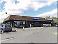
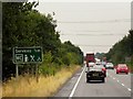
The lifestyle in LN6 9GU is shaped by its small-scale amenities and practical connectivity. Within walking distance are five retail outlets, including Spar Ramper, Lincolnshire Co-operative, and Co-op Severus, offering everyday essentials. The nearby railway stations provide access to broader shopping and leisure opportunities in larger towns. While the area lacks large parks or recreational facilities, its proximity to RAF Waddington may offer unique cultural or historical interests. The mix of local shops and transport links ensures residents can meet daily needs without long commutes. The absence of major leisure venues means the area caters to those prioritising simplicity and convenience over large-scale entertainment. For buyers seeking a self-contained lifestyle with minimal hassle, LN6 9GU’s amenities are functional but unambitious.
Amenities
Schools
Residents of LN6 9GU have access to three primary schools within practical reach. Eagle Community Primary School and North Scarle Primary School both hold Ofsted ratings of satisfactory, while The St Michael’s Church of England Primary School in Thorpe on the Hill is rated good. These options provide a range of educational environments, from state-maintained schools to faith-based institutions. The presence of multiple primary schools suggests a focus on early education, which is crucial for families with young children. However, the absence of secondary schools or further education facilities in the immediate area means residents may need to commute for older children’s schooling. The mix of ratings indicates a varied quality of education, with at least one school performing above average.
| Rank | School | Type | Entry gender | Ages |
|---|
Explore more schools in this area
Go to Schools tabDemographics
The population of LN6 9GU skews towards adults aged 30 to 64, with a median age of 47. This suggests a community of established professionals and families, rather than a mix of younger or older demographics. Home ownership is high, at 81%, indicating a stable, long-term resident base. The area is predominantly composed of houses rather than flats, which aligns with the ownership figures and suggests a preference for private, standalone properties. The predominant ethnic group is White, though specific data on diversity is not provided. The low population density of 54 people per square kilometre means the area avoids the congestion of larger urban centres, offering a more spread-out, less crowded environment. This profile suggests a community focused on comfort and continuity, with limited pressure from transient populations or rental-driven turnover.
Household Size
Accommodation Type
Tenure
Ethnic Group
Religion
Household Composition
Age
Household Deprivation
NS-SEC
Explore more demographic insights in this area
Go to Demographics tabPlanning
Planning Constraints
- Flood RiskPremium
- Ramsar Wetland SitesPremium
- Area of Outstanding Natural BeautyPremium
- Protected Nature ReservePremium
- Protected WoodlandPremium