Area Overview for LN6 9DA
Photos of LN6 9DA


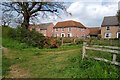
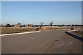
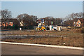

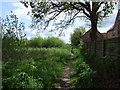


16 photos from this area
Area Information
Key information about the LN6 9DA including its size, population, and administrative classification.
- Area Type
- Postcode
- Area Size
- 1.2 hectares
- Population
- 2087
- Population Density
- 5396 people/km²
House Prices in LN6 9DA
20
Properties
£217,220
Average Sold Price
£158,000
Lowest Price
£347,000
Highest Price
Showing 20 properties
| Address | Type | Beds | Baths | Last Sale Price | Last Sale Date | |
|---|---|---|---|---|---|---|
| 21 Aurelius Way, North Hykeham, Lincoln, LN6 9DA | Detached | 4 | 2 | £347,000 | Jul 2023 | |
| 16 Aurelius Way, North Hykeham, Lincoln, LN6 9DA | Semi-detached | 4 | 1 | £257,000 | Jan 2023 | |
| 15 Aurelius Way, North Hykeham, Lincoln, LN6 9DA | Retail | 3 | 2 | £217,000 | Aug 2022 | |
| 5 Aurelius Way, North Hykeham, Lincoln, LN6 9DA | Retail | 2 | 1 | £187,000 | Mar 2022 | |
| 4 Aurelius Way, North Hykeham, Lincoln, LN6 9DA | house | - | - | £225,000 | Jan 2022 | |
| 10 Aurelius Way, North Hykeham, Lincoln, LN6 9DA | house | - | - | £280,000 | Sep 2021 | |
| 3 Aurelius Way, North Hykeham, Lincoln, LN6 9DA | house | - | - | £182,500 | Sep 2021 | |
| 7 Aurelius Way, North Hykeham, Lincoln, LN6 9DA | Semi-detached | 2 | 1 | £158,000 | Jun 2021 | |
| 1 Aurelius Way, North Hykeham, Lincoln, LN6 9DA | Semi-detached | 2 | 1 | £159,000 | Jun 2020 | |
| 17 Aurelius Way, North Hykeham, Lincoln, LN6 9DA | house | - | - | £221,995 | Dec 2017 |
Page 1 of 2
Energy Efficiency in LN6 9DA
Amenities
Schools
| Rank | School | Type | Entry gender | Ages |
|---|
Explore more schools in this area
Go to Schools tabDemographics
Household Size
Family (3-5 people)
most common
Accommodation Type
Houses
most common
Tenure
70
majority
Ethnic Group
White
most common
Religion
N/A
most common
Household Composition
N/A
most common
Age
47
median
Adults (30-64 years)
most common
Household Deprivation
N/A
with no deprivation
NS-SEC
42
in Lower managerial occupations
Explore more demographic insights in this area
Go to Demographics tabPlanning
Planning Constraints
- Flood RiskPremium
- Ramsar Wetland SitesPremium
- Area of Outstanding Natural BeautyPremium
- Protected Nature ReservePremium
- Protected WoodlandPremium