Area Overview for LN6 8JL
Photos of LN6 8JL
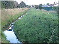
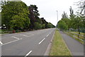
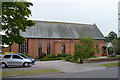

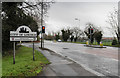
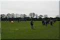

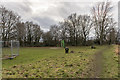


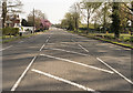

31 photos from this area
Area Information
Key information about the LN6 8JL including its size, population, and administrative classification.
- Area Type
- Postcode
- Area Size
- 1.1 hectares
- Population
- 1044
- Population Density
- 3459 people/km²
House Prices in LN6 8JL
23
Properties
£191,121
Average Sold Price
£64,500
Lowest Price
£330,000
Highest Price
Showing 23 properties
| Address | Type | Beds | Baths | Last Sale Price | Last Sale Date | |
|---|---|---|---|---|---|---|
| 14 Wharfedale Drive, North Hykeham, Lincoln, LN6 8JL | Detached | 3 | 1 | £270,000 | Sep 2024 | |
| 12 Wharfedale Drive, North Hykeham, Lincoln, LN6 8JL | Retail | 4 | 1 | £330,000 | Dec 2021 | |
| 7 Wharfedale Drive, North Hykeham, Lincoln, LN6 8JL | Detached | 3 | 1 | £249,500 | Oct 2018 | |
| 20 Wharfedale Drive, North Hykeham, Lincoln, LN6 8JL | Detached | 4 | 2 | £276,000 | Aug 2018 | |
| 10 Wharfedale Drive, North Hykeham, Lincoln, LN6 8JL | house | - | - | £175,000 | Aug 2017 | |
| 4 Wharfedale Drive, North Hykeham, Lincoln, LN6 8JL | Detached | 3 | 2 | £214,000 | Dec 2015 | |
| 15 Wharfedale Drive, North Hykeham, Lincoln, LN6 8JL | Detached | 3 | - | £148,000 | Feb 2014 | |
| 2 Wharfedale Drive, North Hykeham, Lincoln, LN6 8JL | Detached | 3 | 1 | £187,000 | May 2008 | |
| 19 Wharfedale Drive, North Hykeham, Lincoln, LN6 8JL | Detached | - | - | £196,950 | Jan 2008 | |
| 23 Wharfedale Drive, North Hykeham, Lincoln, LN6 8JL | Semi-detached | - | - | £166,500 | Jul 2005 |
Page 1 of 3
Energy Efficiency in LN6 8JL
Amenities
Schools
| Rank | School | Type | Entry gender | Ages |
|---|
Explore more schools in this area
Go to Schools tabDemographics
Household Size
Two person
most common
Accommodation Type
Houses
most common
Tenure
90
majority
Ethnic Group
White
most common
Religion
N/A
most common
Household Composition
N/A
most common
Age
47
median
Adults (30-64 years)
most common
Household Deprivation
N/A
with no deprivation
NS-SEC
37
in Lower managerial occupations
Explore more demographic insights in this area
Go to Demographics tabPlanning
Planning Constraints
- Flood RiskPremium
- Ramsar Wetland SitesPremium
- Area of Outstanding Natural BeautyPremium
- Protected Nature ReservePremium
- Protected WoodlandPremium