Area Overview for LN6 7RD
Photos of LN6 7RD

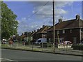
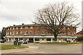
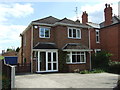
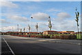

22 photos from this area
Area Information
Key information about the LN6 7RD including its size, population, and administrative classification.
- Area Type
- Postcode
- Area Size
- 1.6 hectares
- Population
- 1636
- Population Density
- 6618 people/km²
House Prices in LN6 7RD
38
Properties
£110,796
Average Sold Price
£27,000
Lowest Price
£235,000
Highest Price
Showing 38 properties
| Address | Type | Beds | Baths | Last Sale Price | Last Sale Date | |
|---|---|---|---|---|---|---|
| 24 Moorland Avenue, Lincoln, LN6 7RD | Semi-detached | 3 | 1 | £220,000 | Nov 2025 | |
| 14 Moorland Avenue, Lincoln, LN6 7RD | Semi-detached | 3 | 1 | £96,851 | Feb 2025 | |
| 4 Moorland Avenue, Lincoln, LN6 7RD | Semi-detached | 3 | 1 | £203,500 | Sep 2023 | |
| 54 Moorland Avenue, Lincoln, LN6 7RD | Semi-detached | 3 | 1 | £230,000 | Mar 2023 | |
| 68 Moorland Avenue, Lincoln, LN6 7RD | Semi-detached | 3 | 1 | £164,950 | Oct 2020 | |
| 66 Moorland Avenue, Lincoln, LN6 7RD | house | 3 | 1 | £158,000 | Nov 2017 | |
| 8 Moorland Avenue, Lincoln, LN6 7RD | house | - | - | £235,000 | Aug 2017 | |
| 34 Moorland Avenue, Lincoln, LN6 7RD | Semi-detached | 1 | 2 | £104,500 | Feb 2017 | |
| 6 Moorland Avenue, Lincoln, LN6 7RD | Semi-detached | 3 | 1 | £125,000 | May 2015 | |
| 44 Moorland Avenue, Lincoln, LN6 7RD | Semi-detached | 3 | - | £95,000 | Nov 2014 |
Page 1 of 4
Energy Efficiency in LN6 7RD
Amenities
Schools
| Rank | School | Type | Entry gender | Ages |
|---|
Explore more schools in this area
Go to Schools tabDemographics
Household Size
Family (3-5 people)
most common
Accommodation Type
Houses
most common
Tenure
48
majority
Ethnic Group
White
most common
Religion
N/A
most common
Household Composition
N/A
most common
Age
47
median
Adults (30-64 years)
most common
Household Deprivation
N/A
with no deprivation
NS-SEC
18
in Lower managerial occupations
Explore more demographic insights in this area
Go to Demographics tabPlanning
Planning Constraints
- Flood RiskPremium
- Ramsar Wetland SitesPremium
- Area of Outstanding Natural BeautyPremium
- Protected Nature ReservePremium
- Protected WoodlandPremium