Area Overview for LN6 5XP
Photos of LN6 5XP
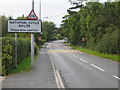

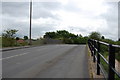


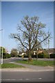


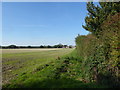
41 photos from this area
Area Information
Key information about the LN6 5XP including its size, population, and administrative classification.
- Area Type
- Postcode
- Area Size
- 9100 m²
- Population
- 1863
- Population Density
- 652 people/km²
House Prices in LN6 5XP
16
Properties
£214,279
Average Sold Price
£71,000
Lowest Price
£330,000
Highest Price
Showing 16 properties
| Address | Type | Beds | Baths | Last Sale Price | Last Sale Date | |
|---|---|---|---|---|---|---|
| 67 Swallow Avenue, Skellingthorpe, Lincoln, LN6 5XP | Bungalow | 3 | 2 | £272,500 | Mar 2025 | |
| 93 Swallow Avenue, Skellingthorpe, Lincoln, LN6 5XP | Retail | 2 | 1 | £235,000 | Jul 2022 | |
| 75 Swallow Avenue, Skellingthorpe, Lincoln, LN6 5XP | house | - | - | £330,000 | Nov 2020 | |
| 63 Swallow Avenue, Skellingthorpe, Lincoln, LN6 5XP | Bungalow | 2 | 1 | £180,000 | Sep 2020 | |
| 89 Swallow Avenue, Skellingthorpe, Lincoln, LN6 5XP | Bungalow | 4 | 2 | £232,500 | Aug 2018 | |
| 73 Swallow Avenue, Skellingthorpe, Lincoln, LN6 5XP | Detached | - | - | £178,950 | Dec 2005 | |
| 71 Swallow Avenue, Skellingthorpe, Lincoln, LN6 5XP | Detached | - | - | £71,000 | Mar 2002 | |
| 79 Swallow Avenue, Skellingthorpe, Lincoln, LN6 5XP | Detached | - | - | - | - | |
| 91 Swallow Avenue, Skellingthorpe, Lincoln, LN6 5XP | Detached | - | - | - | - | |
| 69 Swallow Avenue, Skellingthorpe, Lincoln, LN6 5XP | Detached | - | - | - | - |
Page 1 of 2
Energy Efficiency in LN6 5XP
Amenities
Schools
| Rank | School | Type | Entry gender | Ages |
|---|
Explore more schools in this area
Go to Schools tabDemographics
Household Size
Two person
most common
Accommodation Type
Houses
most common
Tenure
89
majority
Ethnic Group
White
most common
Religion
N/A
most common
Household Composition
N/A
most common
Age
47
median
Adults (30-64 years)
most common
Household Deprivation
N/A
with no deprivation
NS-SEC
34
in Lower managerial occupations
Explore more demographic insights in this area
Go to Demographics tabPlanning
Planning Constraints
- Flood RiskPremium
- Ramsar Wetland SitesPremium
- Area of Outstanding Natural BeautyPremium
- Protected Nature ReservePremium
- Protected WoodlandPremium