Area Overview for LN6 3QA
Photos of LN6 3QA
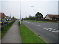
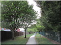
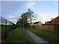
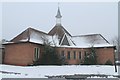


20 photos from this area
Area Information
Key information about the LN6 3QA including its size, population, and administrative classification.
- Area Type
- Postcode
- Area Size
- 2.4 hectares
- Population
- 1331
- Population Density
- 4082 people/km²
House Prices in LN6 3QA
40
Properties
£158,604
Average Sold Price
£39,000
Lowest Price
£335,000
Highest Price
Showing 40 properties
| Address | Type | Beds | Baths | Last Sale Price | Last Sale Date | |
|---|---|---|---|---|---|---|
| 41 Caistor Road, Lincoln, LN6 3QA | Detached | 5 | 3 | £335,000 | Feb 2024 | |
| 43 Caistor Road, Lincoln, LN6 3QA | Detached | 4 | 2 | £287,500 | Jan 2023 | |
| 29 Caistor Road, Lincoln, LN6 3QA | house | - | - | £245,000 | Sep 2021 | |
| 15 Caistor Road, Lincoln, LN6 3QA | Detached | 4 | 2 | £220,000 | Nov 2017 | |
| 2 Caistor Road, Lincoln, LN6 3QA | Detached | 3 | 1 | £190,000 | Oct 2017 | |
| 31 Caistor Road, Lincoln, LN6 3QA | Detached | 3 | 2 | £180,000 | Feb 2017 | |
| 26 Caistor Road, Lincoln, LN6 3QA | Semi-detached | 2 | 1 | £110,000 | Nov 2015 | |
| 7 Caistor Road, Lincoln, LN6 3QA | Bungalow | 3 | - | £226,500 | Oct 2014 | |
| 35 Caistor Road, Lincoln, LN6 3QA | Detached | 4 | - | £162,000 | Feb 2014 | |
| 12 Caistor Road, Lincoln, LN6 3QA | Bungalow | 3 | - | £180,000 | Mar 2013 |
Page 1 of 4
Energy Efficiency in LN6 3QA
Amenities
Schools
| Rank | School | Type | Entry gender | Ages |
|---|
Explore more schools in this area
Go to Schools tabDemographics
Household Size
Two person
most common
Accommodation Type
Houses
most common
Tenure
76
majority
Ethnic Group
White
most common
Religion
N/A
most common
Household Composition
N/A
most common
Age
47
median
Adults (30-64 years)
most common
Household Deprivation
N/A
with no deprivation
NS-SEC
30
in Lower managerial occupations
Explore more demographic insights in this area
Go to Demographics tabPlanning
Planning Constraints
- Flood RiskPremium
- Ramsar Wetland SitesPremium
- Area of Outstanding Natural BeautyPremium
- Protected Nature ReservePremium
- Protected WoodlandPremium