Area Overview for LN6 0RD
Photos of LN6 0RD
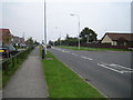
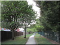
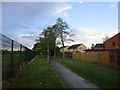
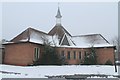


20 photos from this area
Area Information
Key information about the LN6 0RD including its size, population, and administrative classification.
- Area Type
- Postcode
- Area Size
- 1.4 hectares
- Population
- 1420
- Population Density
- 1716 people/km²
House Prices in LN6 0RD
32
Properties
£138,071
Average Sold Price
£55,000
Lowest Price
£255,000
Highest Price
Showing 32 properties
| Address | Type | Beds | Baths | Last Sale Price | Last Sale Date | |
|---|---|---|---|---|---|---|
| 17 Acer Close, Lincoln, LN6 0RD | Bungalow | 2 | 1 | £182,500 | Nov 2024 | |
| 38 Acer Close, Lincoln, LN6 0RD | Bungalow | 3 | 1 | £255,000 | Sep 2024 | |
| 2 Acer Close, Lincoln, LN6 0RD | Bungalow | 3 | 1 | £248,000 | May 2024 | |
| 1 Acer Close, Lincoln, LN6 0RD | Bungalow | 3 | 2 | £235,000 | Nov 2019 | |
| 15 Acer Close, Lincoln, LN6 0RD | Detached | 3 | 1 | £200,000 | Sep 2019 | |
| 34 Acer Close, Lincoln, LN6 0RD | Bungalow | 3 | 1 | £152,000 | Feb 2015 | |
| 4 Acer Close, Lincoln, LN6 0RD | Bungalow | 3 | - | £150,500 | Dec 2013 | |
| 40 Acer Close, Lincoln, LN6 0RD | Bungalow | - | - | £169,000 | Dec 2009 | |
| 21 Acer Close, Lincoln, LN6 0RD | Detached | - | - | £136,500 | Aug 2004 | |
| 26 Acer Close, Lincoln, LN6 0RD | Detached | - | - | £124,000 | Jun 2004 |
Page 1 of 4
Energy Efficiency in LN6 0RD
Amenities
Schools
| Rank | School | Type | Entry gender | Ages |
|---|
Explore more schools in this area
Go to Schools tabDemographics
Household Size
Two person
most common
Accommodation Type
Houses
most common
Tenure
83
majority
Ethnic Group
White
most common
Religion
N/A
most common
Household Composition
N/A
most common
Age
47
median
Adults (30-64 years)
most common
Household Deprivation
N/A
with no deprivation
NS-SEC
34
in Lower managerial occupations
Explore more demographic insights in this area
Go to Demographics tabPlanning
Planning Constraints
- Flood RiskPremium
- Ramsar Wetland SitesPremium
- Area of Outstanding Natural BeautyPremium
- Protected Nature ReservePremium
- Protected WoodlandPremium