Area Overview for LN6 0PS
Photos of LN6 0PS
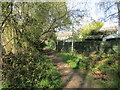
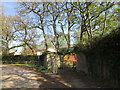
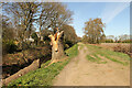
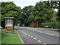
12 photos from this area
Area Information
Key information about the LN6 0PS including its size, population, and administrative classification.
- Area Type
- Postcode
- Area Size
- 1.2 hectares
- Population
- 1425
- Population Density
- 7248 people/km²
House Prices in LN6 0PS
47
Properties
£71,545
Average Sold Price
£6,500
Lowest Price
£190,000
Highest Price
Showing 47 properties
| Address | Type | Beds | Baths | Last Sale Price | Last Sale Date | |
|---|---|---|---|---|---|---|
| 1 Wheatfield Road, Lincoln, LN6 0PS | Flat | 2 | 1 | £67,000 | Jun 2025 | |
| 26 Wheatfield Road, Lincoln, LN6 0PS | Semi-detached | 3 | 1 | £184,000 | Feb 2024 | |
| 37 Wheatfield Road, Lincoln, LN6 0PS | Flat | - | - | £78,000 | Jan 2023 | |
| 8 Wheatfield Road, Lincoln, LN6 0PS | house | - | - | £190,000 | Sep 2022 | |
| 7 Wheatfield Road, Lincoln, LN6 0PS | Flat | 2 | 1 | £52,500 | Sep 2021 | |
| 28 Wheatfield Road, Lincoln, LN6 0PS | house | 2 | - | £90,000 | Jun 2019 | |
| 43 Wheatfield Road, Lincoln, LN6 0PS | Flat | - | - | £73,000 | Mar 2018 | |
| 21 Wheatfield Road, Lincoln, LN6 0PS | Flat | 2 | 1 | £70,000 | May 2017 | |
| 33 Wheatfield Road, Lincoln, LN6 0PS | Flat | 2 | 1 | £67,000 | Jan 2017 | |
| 15 Wheatfield Road, Lincoln, LN6 0PS | Flat | - | - | £76,000 | Oct 2015 |
Page 1 of 5
Energy Efficiency in LN6 0PS
Amenities
Schools
| Rank | School | Type | Entry gender | Ages |
|---|
Explore more schools in this area
Go to Schools tabDemographics
Household Size
One person
most common
Accommodation Type
Houses
most common
Tenure
33
majority
Ethnic Group
White
most common
Religion
N/A
most common
Household Composition
N/A
most common
Age
47
median
Adults (30-64 years)
most common
Household Deprivation
N/A
with no deprivation
NS-SEC
14
in Lower managerial occupations
Explore more demographic insights in this area
Go to Demographics tabPlanning
Planning Constraints
- Flood RiskPremium
- Ramsar Wetland SitesPremium
- Area of Outstanding Natural BeautyPremium
- Protected Nature ReservePremium
- Protected WoodlandPremium