Area Overview for LN5 9SU
Photos of LN5 9SU
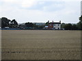
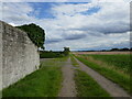
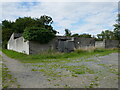
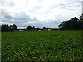
23 photos from this area
Area Information
Key information about the LN5 9SU including its size, population, and administrative classification.
- Area Type
- Postcode
- Area Size
- 2.2 km²
- Population
- 1897
- Population Density
- 51 people/km²
House Prices in LN5 9SU
12
Properties
£165,667
Average Sold Price
£139,000
Lowest Price
£186,000
Highest Price
Showing 12 properties
| Address | Type | Beds | Baths | Last Sale Price | Last Sale Date | |
|---|---|---|---|---|---|---|
| 1, Lowfield Cottages, Station Road, Harmston, Lincoln, LN5 9SU | house | 2 | - | £172,000 | Dec 2019 | |
| Station Crossing Cottage, Station Road, Harmston, Lincoln, LN5 9SU | house | 3 | - | £186,000 | Aug 2012 | |
| Cliff View, Station Road, Harmston, Lincoln, LN5 9SU | Detached | - | - | £139,000 | Sep 2002 | |
| Rls Restoration Ltd, The Old Station, Station Road, Harmston, Lincoln, LN5 9SU | Industrial | - | - | - | - | |
| Land At, The Old Station, Station Road, Harmston, Lincoln, LN5 9SU | warehouse | - | - | - | - | |
| West Lodge, Station Road, Harmston, Lincoln, LN5 9SU | house | - | - | - | - | |
| The Flat, Station House, Station Road, Harmston, Lincoln, LN5 9SU | Bungalow | - | - | - | - | |
| 2, Lowfield Cottages, Station Road, Harmston, Lincoln, LN5 9SU | house | 2 | - | - | - | |
| Station House, Station Road, Harmston, Lincoln, LN5 9SU | Detached | 3 | - | - | - | |
| Landsdale House, Station Road, Harmston, Lincoln, LN5 9SU | Detached | - | - | - | - |
Page 1 of 2
Energy Efficiency in LN5 9SU
Amenities
Schools
| Rank | School | Type | Entry gender | Ages |
|---|
Explore more schools in this area
Go to Schools tabDemographics
Household Size
Two person
most common
Accommodation Type
Houses
most common
Tenure
83
majority
Ethnic Group
White
most common
Religion
N/A
most common
Household Composition
N/A
most common
Age
47
median
Adults (30-64 years)
most common
Household Deprivation
N/A
with no deprivation
NS-SEC
45
in Lower managerial occupations
Explore more demographic insights in this area
Go to Demographics tabPlanning
Planning Constraints
- Flood RiskPremium
- Ramsar Wetland SitesPremium
- Area of Outstanding Natural BeautyPremium
- Protected Nature ReservePremium
- Protected WoodlandPremium