Area Overview for LN5 9HE
Photos of LN5 9HE
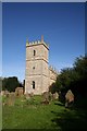

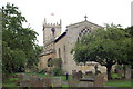
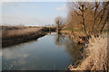
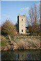


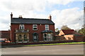
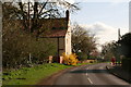
70 photos from this area
Area Information
Key information about the LN5 9HE including its size, population, and administrative classification.
- Area Type
- Postcode
- Area Size
- 1.1 hectares
- Population
- 1511
- Population Density
- 122 people/km²
House Prices in LN5 9HE
55
Properties
£268,219
Average Sold Price
£124,350
Lowest Price
£400,000
Highest Price
Showing 55 properties
| Address | Type | Beds | Baths | Last Sale Price | Last Sale Date | |
|---|---|---|---|---|---|---|
| 9 Lincoln Road, Bassingham, Lincoln, LN5 9HE | Detached | 4 | 2 | £400,000 | Oct 2023 | |
| 5 Lincoln Road, Bassingham, Lincoln, LN5 9HE | Bungalow | 3 | 1 | £279,000 | Oct 2022 | |
| 1 Lincoln Road, Bassingham, Lincoln, LN5 9HE | Bungalow | 2 | - | £199,950 | May 2014 | |
| 17 Lincoln Road, Bassingham, Lincoln, LN5 9HE | house | 5 | - | £339,950 | Apr 2012 | |
| 15 Lincoln Road, Bassingham, Lincoln, LN5 9HE | house | 4 | - | £315,000 | Aug 2011 | |
| 11 Lincoln Road, Bassingham, Lincoln, LN5 9HE | house | 4 | - | £250,000 | Jan 2011 | |
| 3 Lincoln Road, Bassingham, Lincoln, LN5 9HE | Bungalow | 2 | 2 | £124,350 | Jun 2010 | |
| 4 Lincoln Road, Bassingham, Lincoln, LN5 9HE | house | - | - | £237,500 | Apr 2008 | |
| 7 Lincoln Road, Bassingham, Lincoln, LN5 9HE | Detached | 4 | 2 | - | - | |
| 4B, Bassingham Care Home, Lincoln Road, Bassingham, Lincoln, LN5 9HE | Detached | - | - | - | - |
Page 1 of 6
Energy Efficiency in LN5 9HE
Amenities
Schools
| Rank | School | Type | Entry gender | Ages |
|---|
Explore more schools in this area
Go to Schools tabDemographics
Household Size
Two person
most common
Accommodation Type
Houses
most common
Tenure
81
majority
Ethnic Group
White
most common
Religion
N/A
most common
Household Composition
N/A
most common
Age
47
median
Adults (30-64 years)
most common
Household Deprivation
N/A
with no deprivation
NS-SEC
42
in Lower managerial occupations
Explore more demographic insights in this area
Go to Demographics tabPlanning
Planning Constraints
- Flood RiskPremium
- Ramsar Wetland SitesPremium
- Area of Outstanding Natural BeautyPremium
- Protected Nature ReservePremium
- Protected WoodlandPremium