Area Overview for LN5 9AL
Photos of LN5 9AL


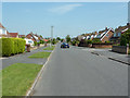

13 photos from this area
Area Information
Key information about the LN5 9AL including its size, population, and administrative classification.
- Area Type
- Postcode
- Area Size
- 3.3 hectares
- Population
- 1512
- Population Density
- 527 people/km²
House Prices in LN5 9AL
38
Properties
£238,128
Average Sold Price
£79,950
Lowest Price
£535,000
Highest Price
Showing 38 properties
| Address | Type | Beds | Baths | Last Sale Price | Last Sale Date | |
|---|---|---|---|---|---|---|
| 433 Brant Road, Waddington, Lincoln, LN5 9AL | house | - | - | £535,000 | Feb 2024 | |
| 435 Brant Road, Waddington, Lincoln, LN5 9AL | Detached | 5 | 3 | £400,000 | Dec 2022 | |
| 451 Brant Road, Waddington, Lincoln, LN5 9AL | Land | 2 | 1 | £480,000 | Jun 2021 | |
| 467 Brant Road, Waddington, Lincoln, LN5 9AL | Semi-detached | 3 | 1 | £185,000 | Jun 2021 | |
| 451A Brant Road, Waddington, Lincoln, LN5 9AL | Detached | - | - | £120,000 | Mar 2021 | |
| 427 Brant Road, Waddington, Lincoln, LN5 9AL | Bungalow | 2 | - | £168,000 | Feb 2021 | |
| 425 Brant Road, Waddington, Lincoln, LN5 9AL | Bungalow | 4 | 1 | £205,000 | Aug 2019 | |
| 465 Brant Road, Waddington, Lincoln, LN5 9AL | Semi-detached | 3 | 1 | £187,000 | Jul 2019 | |
| 459 Brant Road, Waddington, Lincoln, LN5 9AL | house | 5 | 2 | £220,000 | Nov 2018 | |
| 419 Brant Road, Waddington, Lincoln, LN5 9AL | Bungalow | - | - | £156,000 | Nov 2017 |
Page 1 of 4
Energy Efficiency in LN5 9AL
Amenities
Schools
| Rank | School | Type | Entry gender | Ages |
|---|
Explore more schools in this area
Go to Schools tabDemographics
Household Size
Family (3-5 people)
most common
Accommodation Type
Houses
most common
Tenure
84
majority
Ethnic Group
White
most common
Religion
N/A
most common
Household Composition
N/A
most common
Age
47
median
Adults (30-64 years)
most common
Household Deprivation
N/A
with no deprivation
NS-SEC
32
in Lower managerial occupations
Explore more demographic insights in this area
Go to Demographics tabPlanning
Planning Constraints
- Flood RiskPremium
- Ramsar Wetland SitesPremium
- Area of Outstanding Natural BeautyPremium
- Protected Nature ReservePremium
- Protected WoodlandPremium