Area Overview for LN5 8AG
Photos of LN5 8AG
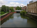
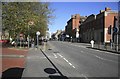
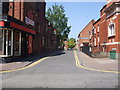
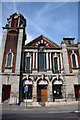
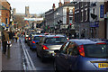
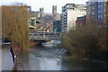


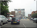
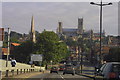

100 photos from this area
Area Information
Key information about the LN5 8AG including its size, population, and administrative classification.
- Area Type
- Postcode
- Area Size
- 6846 m²
- Population
- 1456
- Population Density
- 6813 people/km²
House Prices in LN5 8AG
46
Properties
£86,553
Average Sold Price
£19,000
Lowest Price
£166,000
Highest Price
Showing 46 properties
| Address | Type | Beds | Baths | Last Sale Price | Last Sale Date | |
|---|---|---|---|---|---|---|
| 34 Dixon Street, Lincoln, LN5 8AG | Terraced | 4 | 1 | £160,000 | Oct 2024 | |
| 56 Dixon Street, Lincoln, LN5 8AG | Terraced | 3 | 1 | £117,500 | Jun 2024 | |
| 16 Dixon Street, Lincoln, LN5 8AG | house | 3 | - | £103,000 | Mar 2023 | |
| 74 Dixon Street, Lincoln, LN5 8AG | Terraced | 1 | 1 | £127,500 | Feb 2023 | |
| 82 Dixon Street, Lincoln, LN5 8AG | Terraced | 4 | 1 | £113,000 | Sep 2022 | |
| 78 Dixon Street, Lincoln, LN5 8AG | Terraced | 3 | 1 | £115,000 | Jun 2022 | |
| 52 Dixon Street, Lincoln, LN5 8AG | Terraced | 3 | - | £88,000 | Jan 2022 | |
| 66 Dixon Street, Lincoln, LN5 8AG | Terraced | 5 | - | £166,000 | Apr 2021 | |
| 48 Dixon Street, Lincoln, LN5 8AG | Terraced | 3 | 2 | £105,500 | Jul 2020 | |
| 28 Dixon Street, Lincoln, LN5 8AG | Terraced | 2 | 1 | £81,000 | Jan 2020 |
Page 1 of 5
Energy Efficiency in LN5 8AG
Amenities
Schools
| Rank | School | Type | Entry gender | Ages |
|---|
Explore more schools in this area
Go to Schools tabDemographics
Household Size
One person
most common
Accommodation Type
Houses
most common
Tenure
41
majority
Ethnic Group
White
most common
Religion
N/A
most common
Household Composition
N/A
most common
Age
22
median
Adults (30-64 years)
most common
Household Deprivation
N/A
with no deprivation
NS-SEC
20
in Lower managerial occupations
Explore more demographic insights in this area
Go to Demographics tabPlanning
Planning Constraints
- Flood RiskPremium
- Ramsar Wetland SitesPremium
- Area of Outstanding Natural BeautyPremium
- Protected Nature ReservePremium
- Protected WoodlandPremium