Area Overview for LN5 7UD
Photos of LN5 7UD
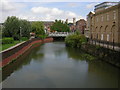
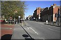
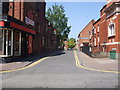
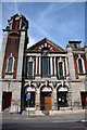
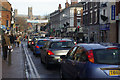
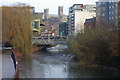


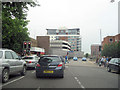
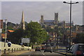

100 photos from this area
Area Information
Key information about the LN5 7UD including its size, population, and administrative classification.
- Area Type
- Postcode
- Area Size
- 1975 m²
- Population
- 2228
- Population Density
- 18277 people/km²
House Prices in LN5 7UD
23
Properties
£80,929
Average Sold Price
£14,000
Lowest Price
£120,000
Highest Price
Showing 23 properties
| Address | Type | Beds | Baths | Last Sale Price | Last Sale Date | |
|---|---|---|---|---|---|---|
| 41 St Andrews Street, Lincoln, LN5 7UD | Terraced | 2 | 1 | £80,000 | Dec 2024 | |
| 39 St Andrews Street, Lincoln, LN5 7UD | Terraced | 2 | 1 | £117,000 | Sep 2024 | |
| 47 St Andrews Street, Lincoln, LN5 7UD | house | 3 | 1 | £94,000 | May 2022 | |
| 43 St Andrews Street, Lincoln, LN5 7UD | Terraced | 3 | 1 | £120,000 | Apr 2022 | |
| 38 St Andrews Street, Lincoln, LN5 7UD | Terraced | 2 | 1 | £100,000 | Mar 2022 | |
| 45 St Andrews Street, Lincoln, LN5 7UD | Terraced | 3 | 1 | £90,000 | Mar 2021 | |
| 57 St Andrews Street, Lincoln, LN5 7UD | Terraced | 2 | 2 | £81,000 | Jun 2018 | |
| 34 St Andrews Street, Lincoln, LN5 7UD | Terraced | 2 | 1 | £75,000 | Aug 2016 | |
| 49 St Andrews Street, Lincoln, LN5 7UD | Terraced | 2 | 1 | £72,500 | Feb 2014 | |
| 53 St Andrews Street, Lincoln, LN5 7UD | house | - | - | £52,000 | Dec 2012 |
Page 1 of 3
Energy Efficiency in LN5 7UD
Amenities
Schools
| Rank | School | Type | Entry gender | Ages |
|---|
Explore more schools in this area
Go to Schools tabDemographics
Household Size
Family (3-5 people)
most common
Accommodation Type
Houses
most common
Tenure
26
majority
Ethnic Group
White
most common
Religion
N/A
most common
Household Composition
N/A
most common
Age
22
median
Young Adults (15-29 years)
most common
Household Deprivation
N/A
with no deprivation
NS-SEC
11
in Lower managerial occupations
Explore more demographic insights in this area
Go to Demographics tabPlanning
Planning Constraints
- Flood RiskPremium
- Ramsar Wetland SitesPremium
- Area of Outstanding Natural BeautyPremium
- Protected Nature ReservePremium
- Protected WoodlandPremium