Area Overview for LN5 0RQ
Photos of LN5 0RQ

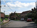
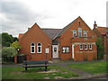
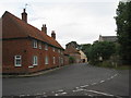
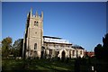


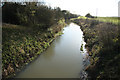


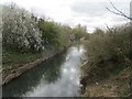
74 photos from this area
Area Information
Key information about the LN5 0RQ including its size, population, and administrative classification.
- Area Type
- Postcode
- Area Size
- 40.6 hectares
- Population
- 2733
- Population Density
- 87 people/km²
House Prices in LN5 0RQ
23
Properties
£292,500
Average Sold Price
£59,000
Lowest Price
£610,000
Highest Price
Showing 23 properties
| Address | Type | Beds | Baths | Last Sale Price | Last Sale Date | |
|---|---|---|---|---|---|---|
| Kingfisher House, Hillside, Beckingham, Lincoln, LN5 0RQ | Detached | 5 | 2 | £610,000 | Mar 2025 | |
| High Leys, Hillside, Beckingham, Lincoln, LN5 0RQ | Detached | 5 | 2 | £405,000 | Jan 2025 | |
| Ardene, Hillside, Beckingham, Lincoln, LN5 0RQ | house | 5 | - | £420,000 | Nov 2017 | |
| Frensham, Hillside, Beckingham, Lincoln, LN5 0RQ | house | 3 | - | £340,000 | May 2017 | |
| Horizons, Hillside, Beckingham, Lincoln, LN5 0RQ | Detached | - | - | £317,500 | Dec 2005 | |
| Witham Bank, Hillside, Beckingham, Lincoln, LN5 0RQ | Bungalow | 4 | 2 | £170,000 | Nov 2002 | |
| Tansy Cottage, Hillside, Beckingham, Lincoln, LN5 0RQ | Detached | - | - | £159,000 | Apr 2001 | |
| Rellim House, Hillside, Beckingham, Lincoln, LN5 0RQ | house | - | - | £152,000 | Jan 2001 | |
| 3, Hillside Cottages, Hillside, Beckingham, Lincoln, LN5 0RQ | house | - | - | £59,000 | May 1995 | |
| 4, Hillside Cotages, Hillside, Beckingham, Lincoln, LN5 0RQ | Terraced | 4 | 2 | - | - |
Page 1 of 3
Energy Efficiency in LN5 0RQ
Amenities
Schools
| Rank | School | Type | Entry gender | Ages |
|---|
Explore more schools in this area
Go to Schools tabDemographics
Household Size
Two person
most common
Accommodation Type
Houses
most common
Tenure
82
majority
Ethnic Group
White
most common
Religion
N/A
most common
Household Composition
N/A
most common
Age
47
median
Adults (30-64 years)
most common
Household Deprivation
N/A
with no deprivation
NS-SEC
39
in Lower managerial occupations
Explore more demographic insights in this area
Go to Demographics tabPlanning
Planning Constraints
- Flood RiskPremium
- Ramsar Wetland SitesPremium
- Area of Outstanding Natural BeautyPremium
- Protected Nature ReservePremium
- Protected WoodlandPremium