Area Overview for LN5 0ER
Photos of LN5 0ER
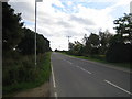
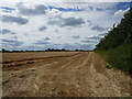
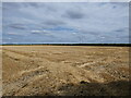
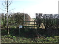

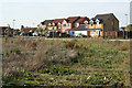
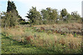
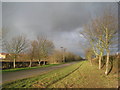
16 photos from this area
Area Information
Key information about the LN5 0ER including its size, population, and administrative classification.
- Area Type
- Postcode
- Area Size
- 4.8 hectares
- Population
- 2124
- Population Density
- 313 people/km²
House Prices in LN5 0ER
59
Properties
£190,341
Average Sold Price
£15,200
Lowest Price
£455,000
Highest Price
Showing 59 properties
| Address | Type | Beds | Baths | Last Sale Price | Last Sale Date | |
|---|---|---|---|---|---|---|
| 35 Chapel Lane, Navenby, Lincoln, LN5 0ER | Bungalow | 4 | 3 | £375,500 | May 2025 | |
| 33 Chapel Lane, Navenby, Lincoln, LN5 0ER | Bungalow | 3 | 1 | £352,500 | Mar 2025 | |
| 7 Chapel Lane, Navenby, Lincoln, LN5 0ER | Bungalow | 3 | 1 | £258,000 | Jan 2025 | |
| 30 Chapel Lane, Navenby, Lincoln, LN5 0ER | Detached | 4 | 2 | £455,000 | Dec 2024 | |
| Chapel House, 3 Chapel Lane, Navenby, Lincoln, LN5 0ER | Detached | 6 | 5 | £440,000 | Apr 2024 | |
| 50 Chapel Lane, Navenby, Lincoln, LN5 0ER | Detached | 4 | 3 | £315,000 | Nov 2023 | |
| 14 Chapel Lane, Navenby, Lincoln, LN5 0ER | Detached | 4 | 2 | £410,000 | Nov 2022 | |
| 37 Chapel Lane, Navenby, Lincoln, LN5 0ER | Bungalow | 3 | 1 | £240,000 | Sep 2022 | |
| 46 Chapel Lane, Navenby, Lincoln, LN5 0ER | Detached | 3 | 2 | £340,000 | Mar 2021 | |
| 12 Chapel Lane, Navenby, Lincoln, LN5 0ER | Detached | 4 | 2 | £355,000 | Apr 2020 |
Page 1 of 6
Energy Efficiency in LN5 0ER
Amenities
Schools
| Rank | School | Type | Entry gender | Ages |
|---|
Explore more schools in this area
Go to Schools tabDemographics
Household Size
Two person
most common
Accommodation Type
Houses
most common
Tenure
77
majority
Ethnic Group
White
most common
Religion
N/A
most common
Household Composition
N/A
most common
Age
47
median
Adults (30-64 years)
most common
Household Deprivation
N/A
with no deprivation
NS-SEC
38
in Lower managerial occupations
Explore more demographic insights in this area
Go to Demographics tabPlanning
Planning Constraints
- Flood RiskPremium
- Ramsar Wetland SitesPremium
- Area of Outstanding Natural BeautyPremium
- Protected Nature ReservePremium
- Protected WoodlandPremium