Area Overview for LN5 0AL
Photos of LN5 0AL


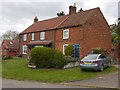


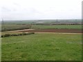
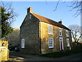
74 photos from this area
Area Information
Key information about the LN5 0AL including its size, population, and administrative classification.
- Area Type
- Postcode
- Area Size
- 4.7 hectares
- Population
- 1897
- Population Density
- 51 people/km²
House Prices in LN5 0AL
24
Properties
£324,629
Average Sold Price
£100,000
Lowest Price
£605,000
Highest Price
Showing 24 properties
| Address | Type | Beds | Baths | Last Sale Price | Last Sale Date | |
|---|---|---|---|---|---|---|
| Wesleyan Chapel, Blind Lane, Coleby, Lincoln, LN5 0AL | Detached | 3 | 2 | £430,000 | Sep 2025 | |
| Stone Cottage, 11 Blind Lane, Coleby, Lincoln, LN5 0AL | house | - | - | £605,000 | Feb 2022 | |
| 19 Blind Lane, Coleby, Lincoln, LN5 0AL | Detached | 3 | 1 | £310,000 | Mar 2020 | |
| White Cottage, 15-17 Blind Lane, Coleby, Lincoln, LN5 0AL | Cottage | 5 | 3 | £518,000 | Dec 2019 | |
| The Willows, 12 Blind Lane, Coleby, Lincoln, LN5 0AL | Bungalow | 3 | 1 | £345,000 | Mar 2019 | |
| 4 Blind Lane, Coleby, Lincoln, LN5 0AL | Bungalow | 4 | 3 | £349,950 | Jul 2016 | |
| 8 Blind Lane, Coleby, Lincoln, LN5 0AL | Bungalow | 3 | - | £171,000 | Mar 2011 | |
| Owls Hoot, Blind Lane, Coleby, Lincoln, LN5 0AL | house | - | - | £277,335 | Oct 2009 | |
| Linton House, 29 Blind Lane, Coleby, Lincoln, LN5 0AL | Detached | - | - | £100,000 | May 2002 | |
| Maple House, 27 Blind Lane, Coleby, Lincoln, LN5 0AL | Detached | 5 | - | £140,000 | Jun 1997 |
Page 1 of 3
Energy Efficiency in LN5 0AL
Amenities
Schools
| Rank | School | Type | Entry gender | Ages |
|---|
Explore more schools in this area
Go to Schools tabDemographics
Household Size
Two person
most common
Accommodation Type
Houses
most common
Tenure
83
majority
Ethnic Group
White
most common
Religion
N/A
most common
Household Composition
N/A
most common
Age
47
median
Adults (30-64 years)
most common
Household Deprivation
N/A
with no deprivation
NS-SEC
45
in Lower managerial occupations
Explore more demographic insights in this area
Go to Demographics tabPlanning
Planning Constraints
- Flood RiskPremium
- Ramsar Wetland SitesPremium
- Area of Outstanding Natural BeautyPremium
- Protected Nature ReservePremium
- Protected WoodlandPremium