Area Overview for LN5 0AH
Photos of LN5 0AH
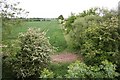
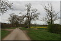
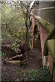
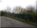
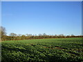
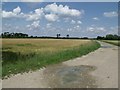
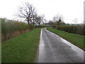
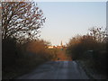
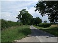
10 photos from this area
Area Information
Key information about the LN5 0AH including its size, population, and administrative classification.
- Area Type
- Postcode
- Area Size
- 1.3 km²
- Population
- 1897
- Population Density
- 51 people/km²
House Prices in LN5 0AH
25
Properties
£281,267
Average Sold Price
£43,000
Lowest Price
£556,667
Highest Price
Showing 25 properties
| Address | Type | Beds | Baths | Last Sale Price | Last Sale Date | |
|---|---|---|---|---|---|---|
| 14A Far Lane, Coleby, Lincoln, LN5 0AH | Bungalow | 3 | 2 | £545,000 | Jul 2024 | |
| Saddlers, 18 Far Lane, Coleby, Lincoln, LN5 0AH | Semi-detached | 3 | 2 | £556,667 | Jun 2022 | |
| 5 Far Lane, Coleby, Lincoln, LN5 0AH | Detached | 4 | 3 | £320,000 | Sep 2020 | |
| 16 Far Lane, Coleby, Lincoln, LN5 0AH | house | - | - | £295,000 | Oct 2019 | |
| Far End, 9 Far Lane, Coleby, Lincoln, LN5 0AH | Bungalow | 4 | - | £330,000 | Mar 2014 | |
| 14 Far Lane, Coleby, Lincoln, LN5 0AH | Detached | 6 | 3 | £250,000 | Aug 2007 | |
| 10 Far Lane, Coleby, Lincoln, LN5 0AH | Terraced | - | - | £138,000 | Jan 2007 | |
| 12 Far Lane, Coleby, Lincoln, LN5 0AH | house | 4 | - | £277,500 | Jul 2006 | |
| 8 Far Lane, Coleby, Lincoln, LN5 0AH | Terraced | - | - | £57,500 | Jan 2001 | |
| 6 Far Lane, Coleby, Lincoln, LN5 0AH | Semi-detached | 2 | 1 | £43,000 | May 2000 |
Page 1 of 3
Energy Efficiency in LN5 0AH
Amenities
Schools
| Rank | School | Type | Entry gender | Ages |
|---|
Explore more schools in this area
Go to Schools tabDemographics
Household Size
Two person
most common
Accommodation Type
Houses
most common
Tenure
83
majority
Ethnic Group
White
most common
Religion
N/A
most common
Household Composition
N/A
most common
Age
47
median
Adults (30-64 years)
most common
Household Deprivation
N/A
with no deprivation
NS-SEC
45
in Lower managerial occupations
Explore more demographic insights in this area
Go to Demographics tabPlanning
Planning Constraints
- Flood RiskPremium
- Ramsar Wetland SitesPremium
- Area of Outstanding Natural BeautyPremium
- Protected Nature ReservePremium
- Protected WoodlandPremium