Area Overview for LN4 4EH
Photos of LN4 4EH

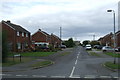
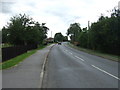
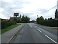
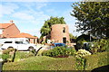
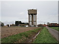
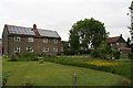

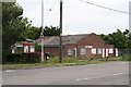
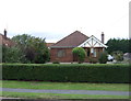
11 photos from this area
Area Information
Key information about the LN4 4EH including its size, population, and administrative classification.
- Area Type
- Postcode
- Area Size
- 1.2 hectares
- Population
- 2776
- Population Density
- 125 people/km²
House Prices in LN4 4EH
10
Properties
£238,563
Average Sold Price
£144,000
Lowest Price
£407,500
Highest Price
Showing 10 properties
| Address | Type | Beds | Baths | Last Sale Price | Last Sale Date | |
|---|---|---|---|---|---|---|
| 18 Walcott Road, Billinghay, Lincoln, LN4 4EH | Detached | 5 | 2 | £407,500 | Nov 2024 | |
| 4 Walcott Road, Billinghay, Lincoln, LN4 4EH | Bungalow | 4 | 2 | £325,000 | Nov 2024 | |
| 46 Walcott Road, Billinghay, Lincoln, LN4 4EH | Detached | 3 | 3 | £275,000 | Jun 2021 | |
| 14 Walcott Road, Billinghay, Lincoln, LN4 4EH | Land | 2 | 1 | £144,000 | May 2021 | |
| Ro-an, 10 Walcott Road, Billinghay, Lincoln, LN4 4EH | Bungalow | 4 | 2 | £155,000 | Dec 2012 | |
| 44 Walcott Road, Billinghay, Lincoln, LN4 4EH | house | 2 | - | £185,000 | Oct 2010 | |
| 48 Walcott Road, Billinghay, Lincoln, LN4 4EH | house | 3 | - | £175,000 | Mar 2010 | |
| Walcott House, 46A Walcott Road, Billinghay, Lincoln, LN4 4EH | Detached | - | - | £242,000 | Dec 2007 | |
| The New Vicarage, 6 Walcott Road, Billinghay, Lincoln, LN4 4EH | Detached | 4 | 2 | - | - | |
| 8 Walcott Road, Billinghay, Lincoln, LN4 4EH | Bungalow | 3 | 3 | - | - |
Energy Efficiency in LN4 4EH
Amenities
Schools
| Rank | School | Type | Entry gender | Ages |
|---|
Explore more schools in this area
Go to Schools tabDemographics
Household Size
Two person
most common
Accommodation Type
Houses
most common
Tenure
65
majority
Ethnic Group
White
most common
Religion
N/A
most common
Household Composition
N/A
most common
Age
47
median
Adults (30-64 years)
most common
Household Deprivation
N/A
with no deprivation
NS-SEC
25
in Lower managerial occupations
Explore more demographic insights in this area
Go to Demographics tabPlanning
Planning Constraints
- Flood RiskPremium
- Ramsar Wetland SitesPremium
- Area of Outstanding Natural BeautyPremium
- Protected Nature ReservePremium
- Protected WoodlandPremium