Area Overview for LN4 4DG
Photos of LN4 4DG

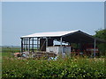

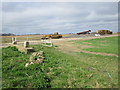
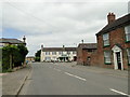
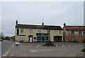
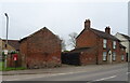

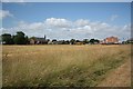


38 photos from this area
Area Information
Key information about the LN4 4DG including its size, population, and administrative classification.
- Area Type
- Postcode
- Area Size
- 77.7 hectares
- Population
- 1275
- Population Density
- 30 people/km²
House Prices in LN4 4DG
47
Properties
£191,842
Average Sold Price
£33,950
Lowest Price
£410,000
Highest Price
Showing 47 properties
| Address | Type | Beds | Baths | Last Sale Price | Last Sale Date | |
|---|---|---|---|---|---|---|
| 82 Main Street, North Kyme, Lincoln, LN4 4DG | Bungalow | 3 | 1 | £266,000 | Oct 2025 | |
| 78 Main Street, North Kyme, Lincoln, LN4 4DG | Semi-detached | 3 | 1 | £262,000 | Jul 2025 | |
| 83 Main Street, North Kyme, Lincoln, LN4 4DG | Detached | 3 | 2 | £204,000 | Jul 2024 | |
| 43 Main Street, North Kyme, Lincoln, LN4 4DG | Detached | 3 | 1 | £120,000 | Apr 2024 | |
| 76 Main Street, North Kyme, Lincoln, LN4 4DG | Semi-detached | 3 | 1 | £220,000 | Mar 2024 | |
| 70 Main Street, North Kyme, Lincoln, LN4 4DG | Terraced | 3 | 1 | £182,500 | Feb 2024 | |
| 48 Main Street, North Kyme, Lincoln, LN4 4DG | house | - | - | £350,000 | Mar 2023 | |
| 46 Main Street, North Kyme, Lincoln, LN4 4DG | Detached | 2 | 1 | £200,000 | May 2022 | |
| 61 Main Street, North Kyme, Lincoln, LN4 4DG | Bungalow | - | - | £225,000 | Sep 2021 | |
| 66 Main Street, North Kyme, Lincoln, LN4 4DG | Bungalow | 4 | 3 | £290,000 | Nov 2020 |
Page 1 of 5
Energy Efficiency in LN4 4DG
Amenities
Schools
| Rank | School | Type | Entry gender | Ages |
|---|
Explore more schools in this area
Go to Schools tabDemographics
Household Size
Two person
most common
Accommodation Type
Houses
most common
Tenure
75
majority
Ethnic Group
White
most common
Religion
N/A
most common
Household Composition
N/A
most common
Age
47
median
Adults (30-64 years)
most common
Household Deprivation
N/A
with no deprivation
NS-SEC
27
in Lower managerial occupations
Explore more demographic insights in this area
Go to Demographics tabPlanning
Planning Constraints
- Flood RiskPremium
- Ramsar Wetland SitesPremium
- Area of Outstanding Natural BeautyPremium
- Protected Nature ReservePremium
- Protected WoodlandPremium