Area Overview for LN4 2ET
Photos of LN4 2ET
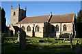
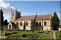
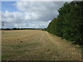
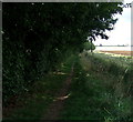
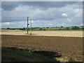
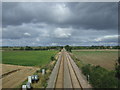
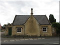
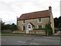
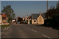
30 photos from this area
Area Information
Key information about the LN4 2ET including its size, population, and administrative classification.
- Area Type
- Postcode
- Area Size
- 26.0 hectares
- Population
- 1987
- Population Density
- 42 people/km²
House Prices in LN4 2ET
38
Properties
£229,786
Average Sold Price
£92,000
Lowest Price
£560,000
Highest Price
Showing 38 properties
| Address | Type | Beds | Baths | Last Sale Price | Last Sale Date | |
|---|---|---|---|---|---|---|
| Brook Villa, Chapel Lane, Dunston, Lincoln, LN4 2ET | Semi-detached | 3 | 2 | £230,000 | Aug 2023 | |
| The New Bungalow, Chapel Lane, Dunston, Lincoln, LN4 2ET | Bungalow | - | - | £365,000 | Sep 2021 | |
| Ivydene, Chapel Lane, Dunston, Lincoln, LN4 2ET | Semi-detached | 2 | 1 | £170,000 | Sep 2021 | |
| Brook House, Chapel Lane, Dunston, Lincoln, LN4 2ET | house | - | - | £560,000 | Aug 2021 | |
| Torbryan, Chapel Lane, Dunston, Lincoln, LN4 2ET | house | - | - | £237,000 | Jul 2021 | |
| The Chestnuts, Chapel Lane, Dunston, Lincoln, LN4 2ET | Bungalow | - | - | £256,000 | Jun 2021 | |
| 13 Chapel Lane, Dunston, Lincoln, LN4 2ET | Semi-detached | 3 | - | £200,000 | Mar 2021 | |
| The Grange, Chapel Lane, Dunston, Lincoln, LN4 2ET | house | - | - | £412,500 | Mar 2021 | |
| Little Leyfields, Chapel Lane, Dunston, Lincoln, LN4 2ET | Bungalow | - | - | £118,000 | Aug 2019 | |
| Dovecote, Chapel Lane, Dunston, Lincoln, LN4 2ET | house | 3 | 2 | £217,500 | May 2019 |
Page 1 of 4
Energy Efficiency in LN4 2ET
Amenities
Schools
| Rank | School | Type | Entry gender | Ages |
|---|
Explore more schools in this area
Go to Schools tabDemographics
Household Size
Two person
most common
Accommodation Type
Houses
most common
Tenure
82
majority
Ethnic Group
White
most common
Religion
N/A
most common
Household Composition
N/A
most common
Age
47
median
Adults (30-64 years)
most common
Household Deprivation
N/A
with no deprivation
NS-SEC
43
in Lower managerial occupations
Explore more demographic insights in this area
Go to Demographics tabPlanning
Planning Constraints
- Flood RiskPremium
- Ramsar Wetland SitesPremium
- Area of Outstanding Natural BeautyPremium
- Protected Nature ReservePremium
- Protected WoodlandPremium