Area Overview for LN4 1RH
Photos of LN4 1RH
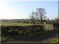


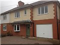
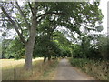


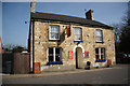
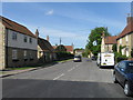

26 photos from this area
Area Information
Key information about the LN4 1RH including its size, population, and administrative classification.
- Area Type
- Postcode
- Area Size
- 2.1 hectares
- Population
- 1852
- Population Density
- 1709 people/km²
House Prices in LN4 1RH
24
Properties
£282,430
Average Sold Price
£71,000
Lowest Price
£609,950
Highest Price
Showing 24 properties
| Address | Type | Beds | Baths | Last Sale Price | Last Sale Date | |
|---|---|---|---|---|---|---|
| 17 Back Lane, Heighington, Lincoln, LN4 1RH | Detached | 5 | 2 | £609,950 | Feb 2023 | |
| Whitegates, Back Lane, Heighington, Lincoln, LN4 1RH | house | - | - | £310,000 | Jan 2019 | |
| The Old Barn, 30 Back Lane, Heighington, Lincoln, LN4 1RH | Semi-detached | 4 | 3 | £515,000 | Mar 2016 | |
| 26 Back Lane, Heighington, Lincoln, LN4 1RH | house | - | - | £500,000 | Jan 2015 | |
| 27 Back Lane, Heighington, Lincoln, LN4 1RH | Detached | 5 | - | £360,000 | Oct 2013 | |
| 25 Back Lane, Heighington, Lincoln, LN4 1RH | Detached | 6 | - | £285,000 | Apr 2013 | |
| 32 Back Lane, Heighington, Lincoln, LN4 1RH | Bungalow | - | - | £330,000 | Apr 2011 | |
| Orchard Cottage, 23 Back Lane, Heighington, Lincoln, LN4 1RH | house | - | - | £165,000 | Nov 2010 | |
| 21 Back Lane, Heighington, Lincoln, LN4 1RH | Detached | 5 | 3 | £292,500 | Jun 2005 | |
| 19 Back Lane, Heighington, Lincoln, LN4 1RH | Detached | - | - | £181,000 | May 2001 |
Page 1 of 3
Energy Efficiency in LN4 1RH
Amenities
Schools
| Rank | School | Type | Entry gender | Ages |
|---|
Explore more schools in this area
Go to Schools tabDemographics
Household Size
Two person
most common
Accommodation Type
Houses
most common
Tenure
87
majority
Ethnic Group
White
most common
Religion
N/A
most common
Household Composition
N/A
most common
Age
47
median
Adults (30-64 years)
most common
Household Deprivation
N/A
with no deprivation
NS-SEC
40
in Lower managerial occupations
Explore more demographic insights in this area
Go to Demographics tabPlanning
Planning Constraints
- Flood RiskPremium
- Ramsar Wetland SitesPremium
- Area of Outstanding Natural BeautyPremium
- Protected Nature ReservePremium
- Protected WoodlandPremium