Area Overview for LN4 1AB
Photos of LN4 1AB
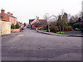

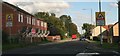

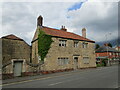
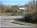


26 photos from this area
Area Information
Key information about the LN4 1AB including its size, population, and administrative classification.
- Area Type
- Postcode
- Area Size
- 10.1 hectares
- Population
- 1690
- Population Density
- 115 people/km²
House Prices in LN4 1AB
39
Properties
£216,911
Average Sold Price
£80,000
Lowest Price
£535,000
Highest Price
Showing 39 properties
| Address | Type | Beds | Baths | Last Sale Price | Last Sale Date | |
|---|---|---|---|---|---|---|
| 20 Fen Road, Washingborough, Lincoln, LN4 1AB | Semi-detached | 3 | 1 | £235,000 | Dec 2024 | |
| 21 Fen Road, Washingborough, Lincoln, LN4 1AB | Semi-detached | 3 | 2 | £290,500 | Apr 2024 | |
| 38 Fen Road, Washingborough, Lincoln, LN4 1AB | house | - | - | £535,000 | Aug 2022 | |
| 13A Fen Road, Washingborough, Lincoln, LN4 1AB | Bungalow | - | - | £279,950 | Sep 2021 | |
| 17 Fen Road, Washingborough, Lincoln, LN4 1AB | Bungalow | 3 | 2 | £130,000 | Oct 2019 | |
| 13 Fen Road, Washingborough, Lincoln, LN4 1AB | Semi-detached | 3 | 1 | £175,000 | Sep 2019 | |
| 37 Fen Road, Washingborough, Lincoln, LN4 1AB | Bungalow | - | - | £185,000 | Aug 2018 | |
| 7A Fen Road, Washingborough, Lincoln, LN4 1AB | house | - | - | £230,000 | Nov 2017 | |
| 25 Fen Road, Washingborough, Lincoln, LN4 1AB | Bungalow | 2 | 2 | £330,000 | Aug 2017 | |
| 34 Fen Road, Washingborough, Lincoln, LN4 1AB | house | - | - | £325,000 | Jul 2017 |
Page 1 of 4
Energy Efficiency in LN4 1AB
Amenities
Schools
| Rank | School | Type | Entry gender | Ages |
|---|
Explore more schools in this area
Go to Schools tabDemographics
Household Size
Two person
most common
Accommodation Type
Houses
most common
Tenure
69
majority
Ethnic Group
White
most common
Religion
N/A
most common
Household Composition
N/A
most common
Age
47
median
Adults (30-64 years)
most common
Household Deprivation
N/A
with no deprivation
NS-SEC
32
in Lower managerial occupations
Explore more demographic insights in this area
Go to Demographics tabPlanning
Planning Constraints
- Flood RiskPremium
- Ramsar Wetland SitesPremium
- Area of Outstanding Natural BeautyPremium
- Protected Nature ReservePremium
- Protected WoodlandPremium