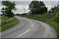
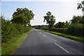
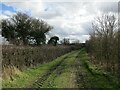
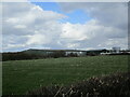
Area Overview for LN3 5TP
Photos of LN3 5TP


Area Information
LN3 5TP is a small residential postcode area in England, covering 55.3 hectares with a population of 2365. Its low population density of 19 people per square kilometre suggests a quiet, spread-out community. The area is characterised by a mix of housing and natural features, though no major protected landscapes extend into it. Daily life here is likely to be calm, with a focus on local amenities and nearby schools. The presence of two primary schools, including Bucknall Primary School with a good Ofsted rating, indicates a family-friendly environment. Residents benefit from low crime risk, with a safety score of 84, and minimal flood risk. While the broadband score is poor, mobile coverage is strong, supporting connectivity for most needs. LN3 5TP is ideal for those seeking a low-key, community-oriented lifestyle with access to essential services within a practical radius.
- Area Type
- Postcode
- Area Size
- 55.3 hectares
- Population
- 2365
- Population Density
- 19 people/km²
LN3 5TP is predominantly an owner-occupied area, with 84% of homes owned by residents rather than rented. The accommodation type is mainly houses, which is typical of smaller, rural or semi-rural postcode areas. This suggests a housing stock that is likely to be older, with fewer high-density developments. The small size of the area means the property market is limited, with a focus on individual homes rather than larger estates. Buyers should consider the limited number of properties available and the potential for a slower-moving market. The high home ownership rate also implies that rental options are scarce, making this area more suitable for those seeking a long-term residence rather than an investment property.
House Prices in LN3 5TP
No properties found in this postcode.
Energy Efficiency in LN3 5TP
The nearest amenities to LN3 5TP include five retail outlets, such as Morrisons Daily Woodhall and Lincolnshire Co-operative Co. These provide access to essential shopping, groceries, and other daily needs within a practical reach. The small area size means that amenities are likely to be closely clustered, offering convenience for residents. While the data does not specify dining or leisure options, the presence of multiple retail venues suggests a basic level of commercial activity. The lifestyle here appears to prioritise practicality, with residents able to access necessary services without long commutes. The combination of retail options and low population density creates a relaxed, community-focused environment.
Amenities
Schools
Residents of LN3 5TP have access to two primary schools: Baumber Primary School and Bucknall Primary School. Bucknall Primary School holds a good Ofsted rating, which is a positive indicator for educational quality. The presence of two primary schools within the area suggests that families with young children can find nearby options for their children’s early education. However, no secondary schools are listed in the data, meaning residents may need to travel further for secondary education. The mix of school types is limited to primary education, which could be a consideration for families requiring a full range of educational facilities.
| Rank | School | Type | Entry gender | Ages |
|---|
Explore more schools in this area
Go to Schools tabDemographics
The population of LN3 5TP has a median age of 47, with the majority aged between 30 and 64 years. This suggests a mature, stable community with a focus on long-term residency. Home ownership is high at 84%, indicating a predominance of owner-occupied properties. The accommodation type is primarily houses, reflecting a more traditional housing stock. The predominant ethnic group is White, with no specific data provided on other demographics. The low population density and age profile suggest a neighbourhood where families and older residents coexist, with limited demand for rental properties. This demographic profile aligns with a quiet, established area where residents are likely to have long-term ties to the community.
Household Size
Accommodation Type
Tenure
Ethnic Group
Religion
Household Composition
Age
Household Deprivation
NS-SEC
Explore more demographic insights in this area
Go to Demographics tabPlanning
Planning Constraints
- Flood RiskPremium
- Ramsar Wetland SitesPremium
- Area of Outstanding Natural BeautyPremium
- Protected Nature ReservePremium
- Protected WoodlandPremium