Area Overview for LN3 4HU
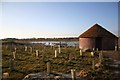
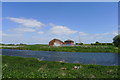
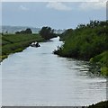
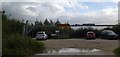
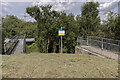
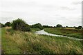
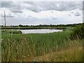
Photos of LN3 4HU

Area Information
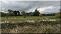
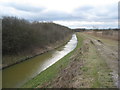
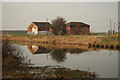
LN3 4HU is a small, tightly knit residential area in England, covering 5.7 km² with a population of 2180 people. Its low population density of 39 people per square kilometre suggests a quiet, low-rise character, typical of rural or semi-rural settings. The area is defined by its modest size and close-knit community feel, where daily life revolves around local amenities and established neighbourhoods. With a median age of 47, it is predominantly home to adults aged 30–64, indicating a mature, stable population. Most residents own their homes, with 81% of properties in private ownership, reflecting a community rooted in long-term residency. The area’s compact nature means residents are likely to know their neighbours, and local services are within easy reach. While it lacks the bustle of larger towns, LN3 4HU offers a peaceful, self-contained environment. Its proximity to nearby towns and amenities ensures a balance between seclusion and accessibility, making it suitable for those seeking a slower pace of life without complete isolation.
- Area Type
- Postcode
- Area Size
- 5.7 km²
- Population
- 2180
- Population Density
- 39 people/km²
The property market in LN3 4HU is characterised by high home ownership (81%) and a focus on houses rather than flats or apartments. This suggests a market that caters to established families and long-term residents, with properties likely to be older, traditional homes rather than modern developments. The small area size of 5.7 km² means the housing stock is limited, which could make the market competitive for buyers seeking properties in this specific postcode. The predominance of houses implies that rental options may be fewer compared to areas with more flats, though the high ownership rate indicates a strong demand for owner-occupied homes. For buyers, this means a focus on individual properties rather than larger developments, with potential for characterful or family-friendly homes. However, the limited size of the area may restrict the availability of new builds or alternative housing types, requiring buyers to look further afield for more options.
House Prices in LN3 4HU
Showing 100 properties
| Address | Type | Beds | Baths | Last Sale Price | Last Sale Date | |
|---|---|---|---|---|---|---|
| Woodlands Farm, Ferry Road, Fiskerton, Lincoln, LN3 4HU | house | - | - | £294,000 | Aug 2021 | |
| Seven Acre Farm, Ferry Road, Fiskerton, Lincoln, LN3 4HU | Detached | 4 | - | £45,000 | Aug 2018 | |
| Shortferry Caravan Park, 7 Witham View, Fiskerton, Lincoln, LN3 4HU | Mobile Home | 1 | 1 | - | - | |
| Short Ferry Caravan Park, 7 Lakeside Crescent, Fiskerton, Lincoln, LN3 4HU | Mobile Home | 2 | 2 | - | - | |
| Shortferry Caravan Park, 15 Witham View, Fiskerton, Lincoln, LN3 4HU | Mobile Home | 2 | 2 | - | - | |
| Shortferry Caravan Park, 17 Witham View, Fiskerton, Lincoln, LN3 4HU | Mobile Home | 2 | 1 | - | - | |
| Short Ferry Caravan Park, 4 Lakeside Crescent, Fiskerton, Lincoln, LN3 4HU | Detached | 4 | 3 | - | - | |
| Fen Farm Cottage, Ferry Road, Fiskerton, Lincoln, LN3 4HU | Mobile Home | 2 | 2 | - | - | |
| Short Ferry Caravan Park, 2 Lakeside Crescent, Fiskerton, Lincoln, LN3 4HU | Mobile Home | 2 | 1 | - | - | |
| Witham View Cottage, Ferry Road, Fiskerton, Lincoln, LN3 4HU | Semi-detached | 4 | 2 | - | - |
Energy Efficiency in LN3 4HU
Residents of LN3 4HU have access to five retail venues within practical reach, including Lincolnshire Co-operative Co and Spar, providing basic shopping needs. These amenities suggest a functional, community-focused lifestyle where daily essentials are available locally. While no parks, leisure facilities, or dining options are listed in the data, the presence of multiple retail outlets indicates a convenience-oriented environment. The small area size means residents are likely to interact with these local services regularly, fostering a sense of familiarity. However, those seeking more extensive leisure or recreational options may need to travel to nearby towns. The retail offerings support a self-sufficient lifestyle, though the lack of specific data on other amenities means the full range of lifestyle options remains unclear.
Amenities
Schools
The nearest school to LN3 4HU is Fiskerton Church of England Primary School, which serves the local community with a primary education offering. Its Ofsted rating of ‘good’ indicates a solid standard of teaching and facilities, though no secondary schools are listed in the data. This means families with children requiring secondary education may need to look beyond the immediate area for options. The presence of a primary school suggests that the area is suitable for young families, with the school likely to be a central part of daily life for many residents. However, the absence of secondary schooling within the postcode highlights a potential limitation for households with older children. Parents should consider the proximity of nearby secondary schools when evaluating the area’s suitability for their needs.
| Rank | School | Type | Entry gender | Ages |
|---|
Explore more schools in this area
Go to Schools tabDemographics
The community in LN3 4HU is predominantly composed of adults aged 30–64, with a median age of 47. This suggests a population that is largely in their prime working years, with a strong presence of middle-aged and older residents. Home ownership is high, with 81% of properties owned by their occupants, indicating a stable, long-term resident base. The area is primarily composed of houses, rather than flats or apartments, which aligns with the demographic profile of older, established households. The predominant ethnic group is White, though no specific data on diversity or minority representation is provided. The low population density of 39 people per square kilometre suggests a spread-out, low-pressure living environment. This combination of age, ownership, and housing type points to a community that values stability and permanence. While no figures on deprivation are available, the high home ownership and mature age profile suggest a relatively affluent, low-volatility demographic.
Household Size
Accommodation Type
Tenure
Ethnic Group
Religion
Household Composition
Age
Household Deprivation
NS-SEC
Explore more demographic insights in this area
Go to Demographics tabPlanning
Planning Constraints
- Flood RiskPremium
- Ramsar Wetland SitesPremium
- Area of Outstanding Natural BeautyPremium
- Protected Nature ReservePremium
- Protected WoodlandPremium