Area Overview for LN3 4FX
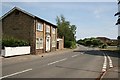
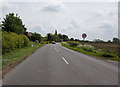
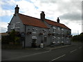
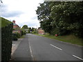
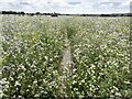
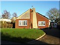
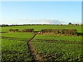
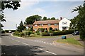
Photos of LN3 4FX

Area Information
LN3 4FX is a small, low-density residential area in England, spanning 7,485 square metres and home to 2,180 residents. Its sparse population—just 39 people per square kilometre—suggests a quiet, perhaps rural or semi-rural character, with homes spaced apart rather than clustered. The area’s compact size means it likely forms a tight-knit community, where daily life is shaped by proximity to local amenities and natural surroundings. With Lincoln Central Railway Station just a short distance away and RAF Waddington nearby, residents have access to transport links that connect to broader regional networks. The presence of a single primary school, Fiskerton Church of England Primary School, indicates a focus on family living, though secondary education options may require commuting. The area’s low population density and modest size suggest it is not a bustling urban hub but rather a place where privacy and space are prioritised, appealing to those seeking a slower pace of life.
- Area Type
- Postcode
- Area Size
- 7485 m²
- Population
- 2180
- Population Density
- 39 people/km²
LN3 4FX is predominantly an owner-occupied area, with 81% of homes owned by residents rather than rented. The accommodation type is exclusively houses, which is unusual for a small postcode area but suggests a focus on family homes or larger properties. This makes the area distinct from high-density urban zones, where flats dominate. The limited size of the area—just 7,485 square metres—means the housing stock is finite, potentially limiting availability for buyers. For those seeking a home here, the emphasis on houses may appeal to those prioritising space and privacy over proximity to city centres. However, the small scale of the area also means that property choices are constrained, and buyers may need to consider nearby regions for more options. The high home ownership rate suggests a stable market, but the lack of rental properties could make it less attractive to investors or those requiring flexibility.
House Prices in LN3 4FX
Showing 5 properties
| Address | Type | Beds | Baths | Last Sale Price | Last Sale Date | |
|---|---|---|---|---|---|---|
| 3 Manor Yard Court, Fiskerton, Lincoln, LN3 4FX | Semi-detached | 3 | 1 | - | - | |
| 1 Manor Yard Court, Fiskerton, Lincoln, LN3 4FX | Terraced | 3 | 2 | - | - | |
| 2 Manor Yard Court, Fiskerton, Lincoln, LN3 4FX | house | - | - | - | - | |
| 5 Manor Yard Court, Fiskerton, Lincoln, LN3 4FX | house | - | - | - | - | |
| 4 Manor Yard Court, Fiskerton, Lincoln, LN3 4FX | house | - | - | - | - |
Energy Efficiency in LN3 4FX
LN3 4FX offers access to a modest selection of retail amenities, including five shops such as Lincolnshire Co-operative Co and Spar, providing basic grocery and convenience services. The nearest railway station, Lincoln Central, connects residents to broader urban centres, while RAF Waddington adds a layer of regional connectivity. The area’s small size means amenities are limited to essentials, but the presence of a primary school and nearby transport hubs suggests a functional, if unadorned, lifestyle. The low population density and lack of detailed data on parks or leisure facilities imply a focus on practicality over luxury. For those prioritising convenience over variety, the area’s amenities are sufficient, but it may not cater to those seeking a vibrant social or recreational scene.
Amenities
Schools
The nearest school to LN3 4FX is Fiskerton Church of England Primary School, which serves the local community with a good Ofsted rating. This primary school is the only educational institution listed in the data, meaning families with older children may need to look beyond the immediate area for secondary education. The presence of a primary school with a good rating indicates a baseline level of quality for early education, though the absence of secondary schools could be a limitation for households with teenagers. For parents prioritising local schooling, this single primary option may be sufficient, but those requiring a full range of educational stages might need to consider commuting to nearby towns. The school’s rating suggests it meets acceptable standards, but without further details on curriculum or facilities, its strengths remain unspecified.
| Rank | School | Type | Entry gender | Ages |
|---|
Explore more schools in this area
Go to Schools tabDemographics
The population of LN3 4FX skews towards adults aged 30–64, with a median age of 47. This suggests a community of middle-aged residents, many of whom may be settled in long-term housing. Home ownership is high at 81%, indicating a stable, owner-occupied demographic rather than a rental market. The majority of properties are houses, not flats, which aligns with the area’s low density and likely suburban or rural setting. The predominant ethnic group is White, with no specific data on other demographics provided. The age profile implies a mature population, potentially with established careers and families, though the absence of data on younger or older residents means the full generational mix remains unclear. The low population density may contribute to a quieter, less congested environment, though it also limits the diversity of local services and social hubs.
Household Size
Accommodation Type
Tenure
Ethnic Group
Religion
Household Composition
Age
Household Deprivation
NS-SEC
Explore more demographic insights in this area
Go to Demographics tabPlanning
Planning Constraints
- Flood RiskPremium
- Ramsar Wetland SitesPremium
- Area of Outstanding Natural BeautyPremium
- Protected Nature ReservePremium
- Protected WoodlandPremium