Area Overview for LN2 5RS
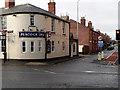
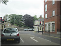
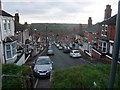
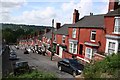
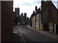
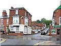
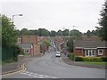
Photos of LN2 5RS


Area Information
LN2 5RS is a compact residential postcode in England, covering 4,244 square metres and home to 2,129 residents. Its high population density of 501,677 people per square kilometre reflects a tightly knit community, though the area’s small size means it is best suited for those prioritising proximity to local amenities over expansive living spaces. The area’s demographic profile is dominated by young adults aged 15–29, with a median age of 22, suggesting a dynamic, possibly student or early-career population. Daily life here is shaped by nearby infrastructure: Lincoln Minster School and Lincoln College provide education options, while rail links to Lincoln Central, Hykeham, and Saxilby stations offer regional connectivity. The area’s compact nature means residents are within practical reach of retail outlets, including Tesco Lincoln and Heron Lincoln, as well as two RAF bases, RAF Waddington and RAF Scampton. While the flood risk is low, the area’s safety profile carries a critical warning: crime rates are above average, with a safety score of just 1/100. This underscores the need for vigilance in a community that, despite its amenities, faces significant security challenges.
- Area Type
- Postcode
- Area Size
- 4244 m²
- Population
- 2129
- Population Density
- 4457 people/km²
LN2 5RS has a home ownership rate of 33%, suggesting that the majority of properties are rented rather than owner-occupied. The accommodation type is primarily houses, which is unusual for a small, high-density area. This mix may indicate a blend of family homes and rental properties, though the limited space suggests that larger properties are rare. Buyers should consider that the area’s compact size may restrict housing stock, with opportunities likely concentrated in nearby towns or villages. The low home ownership rate could reflect affordability challenges or a transient population, possibly linked to the young demographic. For those seeking owner-occupied homes, the market may be competitive, with properties prioritising proximity to schools, rail links, and amenities like Lincoln’s retail hubs. The lack of planning constraints from protected sites or natural beauty areas may also make the area more attractive for development, though the high crime risk remains a critical factor.
House Prices in LN2 5RS
Showing 11 properties
| Address | Type | Beds | Baths | Last Sale Price | Last Sale Date | |
|---|---|---|---|---|---|---|
| 12 Lindum Terrace, Lincoln, LN2 5RS | Detached | - | - | £715,000 | Mar 2020 | |
| 9 Lindum Terrace, Lincoln, LN2 5RS | house | 5 | 3 | £825,000 | Nov 2015 | |
| Flat 8, 8 Lindum Terrace, Lincoln, LN2 5RS | Flat | - | - | - | - | |
| Flat 4, 8 Lindum Terrace, Lincoln, LN2 5RS | Flat | - | - | - | - | |
| Flat 5, 8 Lindum Terrace, Lincoln, LN2 5RS | Flat | - | - | - | - | |
| Flat 2A, 8 Lindum Terrace, Lincoln, LN2 5RS | Maisonette | - | - | - | - | |
| Flat 3, 8 Lindum Terrace, Lincoln, LN2 5RS | Flat | - | - | - | - | |
| Flat 2, 8 Lindum Terrace, Lincoln, LN2 5RS | Maisonette | - | - | - | - | |
| Flat 7, 8 Lindum Terrace, Lincoln, LN2 5RS | Flat | - | - | - | - | |
| Flat 6, 8 Lindum Terrace, Lincoln, LN2 5RS | Flat | - | - | - | - |
Energy Efficiency in LN2 5RS
Residents of LN2 5RS have access to a range of amenities within walking or short driving distance. Retail options include Tesco Lincoln, Heron Lincoln, and the Lincolnshire Co-operative, providing essential shopping and dining choices. The area’s rail links to Lincoln Central and surrounding stations facilitate travel to larger towns for additional services. Nearby RAF bases, RAF Waddington and RAF Scampton, may offer employment or social opportunities for military personnel and their families. While the area lacks large parks or leisure facilities, its proximity to Lincoln suggests access to cultural and recreational amenities in the city. The compact nature of LN2 5RS means daily life is centred around local shops, schools, and transport hubs, creating a self-contained but limited environment. For those valuing convenience over space, the area’s amenities offer practicality, though the high crime risk may impact the perceived quality of life.
Amenities
Schools
Residents of LN2 5RS have access to Lincoln Minster School, an independent institution, and Lincoln College, a sixth-form college. These options cater to different stages of education, from primary through to post-16 studies. The presence of an independent school may appeal to families seeking alternative educational pathways, while Lincoln College provides further education and vocational training. However, the absence of primary or secondary state schools in the immediate area means families may need to travel to nearby towns for comprehensive schooling. The mix of school types reflects a balance between private and public education, though the lack of data on Ofsted ratings or academic performance means it is unclear how these institutions compare nationally. For parents, the proximity to Lincoln’s educational infrastructure could be a draw, but the need to commute for younger children’s schooling is a practical consideration.
| Rank | School | Type | Entry gender | Ages |
|---|
Explore more schools in this area
Go to Schools tabDemographics
The population of LN2 5RS is overwhelmingly young, with a median age of 22 and 72% of residents falling within the 15–29 age bracket. This suggests a community skewed towards students, recent graduates, or early-career professionals. Home ownership is relatively low at 33%, indicating a rental market that may cater to transient or budget-conscious residents. The predominant accommodation type is houses, though the small area size and high density imply limited space for larger properties. Ethnically, the area is predominantly White, with no data provided on other groups. The high proportion of young adults may reflect student populations or those working in nearby sectors, but the lack of deprivation data means it is unclear how this affects quality of life. The demographic profile points to a youthful, possibly transient community, though the high crime risk could deter long-term settlement.
Household Size
Accommodation Type
Tenure
Ethnic Group
Religion
Household Composition
Age
Household Deprivation
NS-SEC
Explore more demographic insights in this area
Go to Demographics tabPlanning
Planning Constraints
- Flood RiskPremium
- Ramsar Wetland SitesPremium
- Area of Outstanding Natural BeautyPremium
- Protected Nature ReservePremium
- Protected WoodlandPremium