Area Overview for LN2 5PN
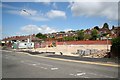
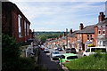
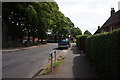
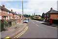
Photos of LN2 5PN


Area Information
LN2 5PN is a compact residential postcode area in England, covering 1,462 square metres and home to 1,814 residents. Its high population density—over 1.2 million people per square kilometre—reflects a tightly knit community, though the area remains small enough to foster familiarity. Daily life here is shaped by its proximity to essential services, including retail outlets, railway stations, and nearby airports. The area’s character is defined by its mature demographic, with a median age of 47 and a majority of residents aged 30–64. This suggests a stable, established population, likely drawn to the area’s practical amenities and connectivity. While the postcode is limited in size, it offers a mix of housing types, predominantly homes, and is served by key infrastructure such as Lincoln Central Railway Station and major retail chains. Living here balances urban convenience with a sense of local cohesion, though the density may mean limited green space. For buyers, the area’s compact nature means properties are closely grouped, with a focus on proximity to transport and services rather than expansive surroundings.
- Area Type
- Postcode
- Area Size
- 1462 m²
- Population
- 1814
- Population Density
- 4577 people/km²
The property market in LN2 5PN is characterised by a 38% home ownership rate, with houses forming the predominant accommodation type. This suggests a mix of owner-occupied and rental properties, though the exact proportion of rentals is not specified. Given the small area size and high population density, the housing stock is likely limited in number, with properties closely clustered. The presence of houses rather than flats or apartments indicates a focus on traditional family homes, which may appeal to buyers seeking space and privacy. However, the small scale of the area means the market is likely tight, with limited scope for expansion. Buyers should consider the proximity to amenities and transport when evaluating properties, as these are key selling points in such a densely populated postcode.
House Prices in LN2 5PN
Showing 9 properties
| Address | Type | Beds | Baths | Last Sale Price | Last Sale Date | |
|---|---|---|---|---|---|---|
| 172 Monks Road, Lincoln, LN2 5PN | Terraced | 2 | 2 | £118,000 | Sep 2022 | |
| 168 Monks Road, Lincoln, LN2 5PN | Terraced | 3 | 1 | £132,000 | Jun 2021 | |
| 170 Monks Road, Lincoln, LN2 5PN | house | - | - | £129,950 | Mar 2016 | |
| 178 Monks Road, Lincoln, LN2 5PN | Terraced | - | - | £45,000 | Jul 1995 | |
| Flat B, 172 Monks Road, Lincoln, LN2 5PN | Flat | 2 | - | - | - | |
| Flat A, 172 Monks Road, Lincoln, LN2 5PN | Terraced | 2 | 2 | - | - | |
| 176 Monks Road, Lincoln, LN2 5PN | Terraced | 3 | - | - | - | |
| Kenwick House, Monks Road, Lincoln, LN2 5PN | Terraced | - | - | - | - | |
| 174 Monks Road, Lincoln, LN2 5PN | Terraced | - | - | - | - |
Energy Efficiency in LN2 5PN
The lifestyle in LN2 5PN is shaped by its proximity to retail, transport, and aviation hubs. Within practical reach are five retail outlets, including Lincolnshire Co-operative Co, Tesco Lincoln, and Aldi St, offering a range of shopping options. The area’s two railway stations—Lincoln Central and Hykeham—provide access to broader regional networks, while nearby RAF Waddington and RAF Scampton airports cater to those requiring air travel. Though the data does not specify parks or leisure facilities, the presence of multiple retail and transport options suggests a focus on convenience over expansive recreational spaces. The compact nature of the area means daily life is centred around these core amenities, with a balance between urban accessibility and the need for nearby green spaces. The mix of retail and transport infrastructure supports a practical, service-oriented lifestyle, ideal for those prioritising connectivity and ease of access.
Amenities
Schools
The nearest school to LN2 5PN is Lincoln Monks Abbey Primary School, which holds a ‘good’ Ofsted rating. As a primary school, it serves the local community’s younger population, offering education for children aged 4–11. The absence of secondary schools in the immediate vicinity means families may need to travel to nearby areas for higher education. However, the ‘good’ rating indicates a reliable standard of teaching and facilities, which is a positive factor for parents prioritising quality education. The single school listed suggests a focus on primary education in the area, with no indication of specialist provision or additional educational facilities. Families should consider the need for secondary schooling when assessing the area’s suitability for long-term living.
| Rank | School | Type | Entry gender | Ages |
|---|
Explore more schools in this area
Go to Schools tabDemographics
The community in LN2 5PN is predominantly composed of adults aged 30–64, with a median age of 47. This suggests a mature, settled population, likely with established careers and families. Home ownership rates stand at 38%, indicating that nearly two-thirds of properties are rented, which may reflect a mix of long-term residents and transient occupants. The area is primarily composed of houses, rather than flats or apartments, aligning with the demographic profile of older, family-oriented households. The predominant ethnic group is White, though no specific data on diversity or deprivation is provided. The high population density—over 1.2 million people per square kilometre—raises questions about living space per person, though the exact implications for quality of life are not quantified in the data. The absence of detailed diversity metrics means the community’s composition remains broadly defined.
Household Size
Accommodation Type
Tenure
Ethnic Group
Religion
Household Composition
Age
Household Deprivation
NS-SEC
Explore more demographic insights in this area
Go to Demographics tabPlanning
Planning Constraints
- Flood RiskPremium
- Ramsar Wetland SitesPremium
- Area of Outstanding Natural BeautyPremium
- Protected Nature ReservePremium
- Protected WoodlandPremium