Area Overview for LN2 5LN
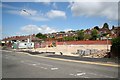
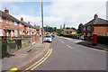
Photos of LN2 5LN


Area Information
Living in LN2 5LN means being part of a tightly knit residential cluster in England, where 1,814 people reside across just 2 hectares. This small area has a high population density of 90,950 people per square kilometre, reflecting a compact, urbanised environment. The community here is predominantly composed of adults aged 30–64, with a median age of 47, suggesting a mature, stable population. Daily life is shaped by proximity to amenities: within practical reach are two railway stations, two airports, and five retail outlets including Tesco Lincoln and Aldi St. The area’s broadband score of 100 ensures seamless digital connectivity, while mobile coverage of 85 supports reliable communication. Though small, LN2 5LN offers a mix of practicality and accessibility, with residents able to access essential services nearby. The absence of environmental constraints like protected woodlands or AONB designations means development is not restricted, though the area’s compact size means it is best suited for those prioritising convenience over expansive living spaces.
- Area Type
- Postcode
- Area Size
- 2.0 hectares
- Population
- 1814
- Population Density
- 4577 people/km²
LN2 5LN is a small area dominated by houses, with 38% of residents owning their homes. This suggests a mix of owner-occupied and rental properties, though the exact proportion of rentals is not specified. Given the area’s compact size and high population density, housing stock is likely limited, making it a niche market for buyers seeking proximity to amenities. The predominance of houses over flats or apartments may appeal to those prioritising space, though the small area size means housing options are constrained. Buyers should consider the area’s proximity to Lincoln Central Railway Station and nearby airports, which may enhance its appeal for commuters. However, the high population density and limited land area may restrict future development, making this a saturated market where properties are likely to be in demand due to their strategic location.
House Prices in LN2 5LN
Showing 2 properties
| Address | Type | Beds | Baths | Last Sale Price | Last Sale Date | |
|---|---|---|---|---|---|---|
| Electromec, 6 Monks Way, Lincoln, LN2 5LN | Industrial | - | - | - | - | |
| Cool Milk, 4 Monks Way, Lincoln, LN2 5LN | office_workshop | - | - | - | - |
Energy Efficiency in LN2 5LN
Residents of LN2 5LN have access to a range of amenities within practical reach. Retail options include Tesco Lincoln, Aldi St, and Lincolnshire Co-operative Co, offering everyday shopping needs. The area’s proximity to Lincoln Central Railway Station and Hykeham Station provides easy access to regional travel, while RAF Waddington and RAF Scampton cater to those needing air travel. Though the area itself is small, its location near Lincoln’s urban core likely extends lifestyle options further afield. The presence of multiple retail outlets and transport hubs suggests a practical, convenience-focused lifestyle, though the lack of parks or leisure facilities within the postcode may require residents to seek recreation in nearby areas. The compact nature of LN2 5LN means amenities are concentrated, making daily errands efficient but limiting space for expansive leisure activities.
Amenities
Schools
The nearest school to LN2 5LN is Lincoln Monks Abbey Primary School, which serves the local community with a primary education offering. It holds an Ofsted rating of ‘good’, indicating a satisfactory standard of teaching and student outcomes. While no secondary schools are listed, the presence of a primary school suggests families with younger children may find the area suitable for early education. The absence of secondary schools nearby could be a consideration for parents planning long-term schooling for their children, though the proximity to Lincoln’s urban centres may provide alternative options. The single school listed reflects the area’s small size, meaning residents may need to travel to adjacent areas for higher education.
| Rank | School | Type | Entry gender | Ages |
|---|
Explore more schools in this area
Go to Schools tabDemographics
The population of LN2 5LN is largely composed of adults aged 30–64, with a median age of 47. This suggests a community of established professionals and families, rather than a younger or elderly demographic. Home ownership stands at 38%, indicating that nearly two-thirds of residents are renters, which may reflect the area’s limited housing stock or affordability pressures. The predominant accommodation type is houses, though the exact mix of owner-occupied versus rental properties is not specified. The predominant ethnic group is White, with no data provided on other ethnicities. The high population density of 90,950 people per square kilometre implies a compact, possibly urbanised setting, though the area’s small size of 2 hectares means it is not a sprawling suburb. This density may impact living space per household but aligns with the presence of nearby retail and transport hubs.
Household Size
Accommodation Type
Tenure
Ethnic Group
Religion
Household Composition
Age
Household Deprivation
NS-SEC
Explore more demographic insights in this area
Go to Demographics tabPlanning
Planning Constraints
- Flood RiskPremium
- Ramsar Wetland SitesPremium
- Area of Outstanding Natural BeautyPremium
- Protected Nature ReservePremium
- Protected WoodlandPremium