Area Overview for LN2 5BE
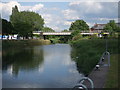
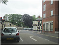
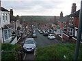
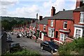
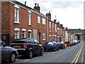
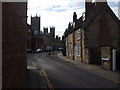
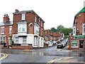
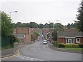
Photos of LN2 5BE


Area Information
Living in LN2 5BE offers a compact, densely populated residential experience within a 1474 m² area. With a population of 2129 people, this postcode is characterised by high density, though its small size means it is a tightly knit cluster of homes. The area’s proximity to Lincoln, a historic city with cultural and economic significance, provides access to broader urban amenities while retaining a localised feel. Daily life here is shaped by its young demographic, with 22-year-olds forming the median age and young adults aged 15–29 making up the majority. The area’s limited size means residents are close to essential services, though its small footprint also means it is not a destination for sprawling suburban living. The presence of nearby schools, rail links, and retail options suggests a practical, functional lifestyle. However, the area’s high crime risk, rated critical with a safety score of 1/100, is a notable concern for potential residents. Despite this, LN2 5BE remains a viable option for those prioritising proximity to Lincoln’s infrastructure over expansive living space.
- Area Type
- Postcode
- Area Size
- 1474 m²
- Population
- 2129
- Population Density
- 4457 people/km²
The property market in LN2 5BE is dominated by rental activity, with only 33% of homes owned by residents. This suggests a transient population, possibly driven by students or temporary workers connected to nearby Lincoln. The accommodation type is primarily houses, which in such a small area likely means modest, single-family homes rather than high-density housing. This mix implies limited property diversity, with few options for apartments or larger family homes. For buyers, the small area size means competition for available properties, though the focus on houses may appeal to those seeking traditional, low-rise living. However, the high crime risk could deter investment, as safety concerns may affect property value and desirability. Prospective buyers should consider the area’s proximity to Lincoln’s amenities, which could offset its compact nature, but also weigh the risks associated with a community where ownership is not the norm.
House Prices in LN2 5BE
Showing 7 properties
| Address | Type | Beds | Baths | Last Sale Price | Last Sale Date | |
|---|---|---|---|---|---|---|
| 2 Montague Terrace, Lincoln, LN2 5BE | Terraced | 2 | 1 | £110,000 | Oct 2024 | |
| 7 Montague Terrace, Lincoln, LN2 5BE | Terraced | 3 | 1 | £112,000 | Jun 2023 | |
| 6 Montague Terrace, Lincoln, LN2 5BE | house | 1 | 2 | £120,000 | Aug 2022 | |
| 5 Montague Terrace, Lincoln, LN2 5BE | Terraced | 3 | 1 | £85,000 | Feb 2021 | |
| 3 Montague Terrace, Lincoln, LN2 5BE | Terraced | 3 | 1 | £68,000 | Dec 2014 | |
| 4 Montague Terrace, Lincoln, LN2 5BE | Terraced | 3 | 1 | £109,950 | Sep 2007 | |
| 1 Montague Terrace, Lincoln, LN2 5BE | Retail | 3 | 1 | £49,950 | Sep 2002 |
Energy Efficiency in LN2 5BE
Residents of LN2 5BE have access to a range of amenities within practical reach. Retail options include Lincolnshire Co-operative Co, Heron Lincoln, and Tesco Lincoln, providing everyday shopping needs. The area’s rail links to Lincoln Central, Hykeham, and Saxilby offer easy access to the city’s cultural and commercial hubs. For leisure, the proximity to RAF Waddington and RAF Scampton may provide unique opportunities, though these are military sites. The lack of named parks or leisure facilities in the data means outdoor recreation may require travel to Lincoln or nearby towns. Dining options are not explicitly listed, but the presence of retail chains suggests a focus on convenience over specialist eateries. Overall, the area’s lifestyle balances practicality with limited local diversification, requiring residents to look beyond LN2 5BE for full recreational or culinary experiences.
Amenities
Schools
Residents of LN2 5BE have access to two notable educational institutions: Lincoln Minster School, an independent school offering primary and secondary education, and Lincoln College, a sixth-form college specialising in further education. Lincoln Minster School’s independent status suggests it may have selective admissions and higher fees, catering to families seeking private education. Lincoln College, meanwhile, provides post-16 education, making it a key resource for older students. The combination of independent and sixth-form institutions indicates a mixed educational landscape, offering options for both younger children and those preparing for higher education or vocational training. For families, this mix could be advantageous, allowing choice between state and private schooling. However, the absence of primary schools in the immediate area means young children may need to commute to Lincoln or nearby towns for early education.
| Rank | School | Type | Entry gender | Ages |
|---|
Explore more schools in this area
Go to Schools tabDemographics
LN2 5BE is predominantly inhabited by young adults, with 15–29-year-olds forming the most common age range. The median age of 22 reflects a community skewed towards students, early-career professionals, or those in transient employment. Home ownership here is relatively low, with only 33% of residents owning their homes. The majority of accommodation is houses, though the area’s small size suggests these are likely single-family dwellings rather than large estates. The predominant ethnic group is White, though no specific data on diversity or deprivation is provided. The high population density—1444038 people per km²—indicates a compact, possibly urbanised environment. For quality of life, the lack of detailed deprivation data means it is unclear whether the community faces socioeconomic challenges. However, the low flood risk and absence of protected natural areas suggest minimal environmental constraints. This profile paints a picture of a youthful, transient population living in a tightly packed residential area with limited long-term stability.
Household Size
Accommodation Type
Tenure
Ethnic Group
Religion
Household Composition
Age
Household Deprivation
NS-SEC
Explore more demographic insights in this area
Go to Demographics tabPlanning
Planning Constraints
- Flood RiskPremium
- Ramsar Wetland SitesPremium
- Area of Outstanding Natural BeautyPremium
- Protected Nature ReservePremium
- Protected WoodlandPremium