Area Overview for LN2 4ZE
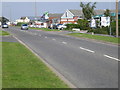
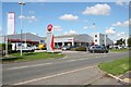
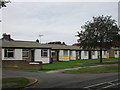
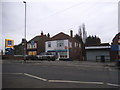
Photos of LN2 4ZE

Area Information
LN2 4ZE is a small, tightly packed residential area in England, spanning just 3,955 square metres and home to 2,561 residents. Its high population density of 647,579 people per square kilometre reflects a compact, closely knit community. This postcode area is defined by its modest size and the proximity of its residents to local amenities and transport links. Daily life here is characterised by a balance of practicality and accessibility, with residents within reach of shops, rail services, and nearby airports. The area’s appeal lies in its simplicity: a place where proximity to essentials is prioritised, and the community feels both intimate and functional. While it lacks sprawling landscapes or grand architecture, its strength is in its efficiency. For those seeking a no-frills, well-connected living environment, LN2 4ZE offers a straightforward alternative to more sprawling suburbs. Its small footprint means that everything needed for daily life is within a short walk or drive, making it ideal for those who value convenience over space.
- Area Type
- Postcode
- Area Size
- 3955 m²
- Population
- 2561
- Population Density
- 4798 people/km²
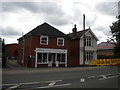
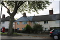
The property market in LN2 4ZE is dominated by owner-occupied homes, with 66% of residents owning their properties. This contrasts with areas where rental markets dominate, suggesting a community of long-term residents rather than a transient population. The accommodation type is primarily houses, which is unusual for a small postcode area but may indicate a mix of older, larger homes and newer builds. Given the high population density and limited area size, the housing stock is constrained, meaning properties are likely to be in close proximity to one another. For buyers, this means competition for available homes and a focus on proximity to amenities. The area’s compact nature also means that properties are likely to be in high demand for their practicality and ease of access to transport links, making it a strategic choice for those prioritising convenience over expansive living spaces.
House Prices in LN2 4ZE
Showing 52 properties
| Address | Type | Beds | Baths | Last Sale Price | Last Sale Date | |
|---|---|---|---|---|---|---|
| 113, Palatine House, Olsen Rise, Lincoln, LN2 4ZE | Flat | 2 | 2 | - | - | |
| 173, Palatine House, Olsen Rise, Lincoln, LN2 4ZE | Flat | 2 | 2 | - | - | |
| 179, Palatine House, Olsen Rise, Lincoln, LN2 4ZE | Flat | 2 | 1 | - | - | |
| 129, Palatine House, Olsen Rise, Lincoln, LN2 4ZE | Flat | 2 | 2 | - | - | |
| 183, Palatine House, Olsen Rise, Lincoln, LN2 4ZE | Flat | 2 | 2 | - | - | |
| 191, Palatine House, Olsen Rise, Lincoln, LN2 4ZE | Flat | 2 | 2 | - | - | |
| 175, Palatine House, Olsen Rise, Lincoln, LN2 4ZE | Flat | 2 | 2 | - | - | |
| 111, Palatine House, Olsen Rise, Lincoln, LN2 4ZE | Flat | 2 | 1 | - | - | |
| 189, Palatine House, Olsen Rise, Lincoln, LN2 4ZE | Flat | 2 | 1 | - | - | |
| 127, Palatine House, Olsen Rise, Lincoln, LN2 4ZE | Flat | 2 | 2 | - | - |
Energy Efficiency in LN2 4ZE
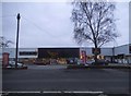
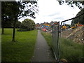
Living in LN2 4ZE offers a mix of practical amenities within easy reach. The area has five retail outlets, including Lidl Deacon Road, Aldi St, and the Lincolnshire Co-operative Co, ensuring residents have access to everyday shopping needs without needing to travel far. Two rail stations—Lincoln Central and Hykeham—provide regular services to nearby towns and cities, while RAF Scampton and RAF Waddington airports offer additional transport options for those requiring air travel. The absence of large parks or leisure facilities means the area is more focused on functional living than recreational spaces, but the proximity to rail and retail ensures a lifestyle centred on convenience. For those who prioritise ease of access to shops, transport, and nearby airports, LN2 4ZE delivers a straightforward, no-frills approach to daily living.
Amenities
Schools
| Rank | School | Type | Entry gender | Ages |
|---|
Explore more schools in this area
Go to Schools tabDemographics
The population of LN2 4ZE skews towards adults aged 30–64, with a median age of 47. This suggests a mature, stable community where most residents are likely to be in their prime working or retirement years. Home ownership is high at 66%, indicating a preference for long-term residency over rental properties. The area is predominantly composed of houses rather than flats, which aligns with the demographic profile of older, established households. The predominant ethnic group is White, reflecting a homogenous community. The high population density—over 600,000 people per square kilometre—means living spaces are closely packed, which can foster a strong sense of local identity but may also limit personal space. This density, combined with the age profile, suggests a community that values stability and familiarity, with fewer young families or transient populations.
Household Size
Accommodation Type
Tenure
Ethnic Group
Religion
Household Composition
Age
Household Deprivation
NS-SEC
Explore more demographic insights in this area
Go to Demographics tabPlanning
Planning Constraints
- Flood RiskPremium
- Ramsar Wetland SitesPremium
- Area of Outstanding Natural BeautyPremium
- Protected Nature ReservePremium
- Protected WoodlandPremium