Area Overview for LN2 4WD
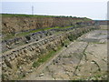
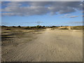
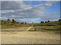
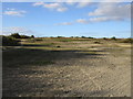
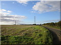
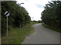
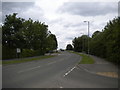
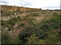
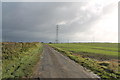
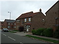
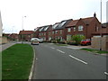
Photos of LN2 4WD

Area Information
LN2 4WD is a compact residential postcode area in England, spanning 5,966 square metres and home to 2,561 residents. Its high population density of 429,289 people per square kilometre reflects a tightly knit community, though the area’s small size means it is more of a cluster than a sprawling suburb. Daily life here is shaped by its proximity to key infrastructure, including two railway stations and two airfields, which offer both local and regional connectivity. The area’s demographics suggest a mature population, with a median age of 47 and a majority of residents aged 30–64. This demographic profile indicates a stable, established community, with a strong emphasis on home ownership—66% of properties are owner-occupied. The housing stock is predominantly composed of houses, which contributes to a quieter, more private living environment compared to high-density flats. While the area lacks natural constraints like protected woodlands or wetlands, its compact nature means residents are close to essential amenities, though the limited size may restrict opportunities for expansion or new developments.
- Area Type
- Postcode
- Area Size
- 5966 m²
- Population
- 2561
- Population Density
- 4798 people/km²
The property market in LN2 4WD is characterised by a high rate of home ownership—66% of residents own their homes—which suggests a stable and established community. The accommodation type is predominantly houses, indicating a focus on single-family homes rather than flats or apartments. This makes the area more attractive to buyers seeking private, spacious living arrangements, though the small size of the postcode may limit the availability of properties. The high home ownership rate also implies that the market is less influenced by rental demand, which could mean fewer opportunities for investors seeking rental income. For buyers, this suggests a market where properties are likely to hold value over time, but the limited size of the area means competition for available homes could be intense. Proximity to rail and air transport infrastructure may also enhance the appeal of properties in this area for commuters or those requiring regional connectivity.
House Prices in LN2 4WD
Showing 15 properties
| Address | Type | Beds | Baths | Last Sale Price | Last Sale Date | |
|---|---|---|---|---|---|---|
| 6 Stukeley Close, Lincoln, LN2 4WD | Semi-detached | 4 | 2 | £280,000 | Jun 2025 | |
| 9 Stukeley Close, Lincoln, LN2 4WD | Semi-detached | 4 | 2 | £285,000 | Aug 2023 | |
| 10 Stukeley Close, Lincoln, LN2 4WD | house | 3 | 2 | £230,000 | Mar 2023 | |
| 4 Stukeley Close, Lincoln, LN2 4WD | Detached | 4 | 1 | £270,000 | Nov 2022 | |
| 3 Stukeley Close, Lincoln, LN2 4WD | Detached | 4 | 1 | £245,000 | Jun 2021 | |
| 5 Stukeley Close, Lincoln, LN2 4WD | Detached | 3 | 1 | £215,000 | May 2019 | |
| 1 Stukeley Close, Lincoln, LN2 4WD | Semi-detached | 3 | 3 | £195,000 | Jan 2019 | |
| 15 Stukeley Close, Lincoln, LN2 4WD | Detached | 4 | 1 | £275,000 | Nov 2017 | |
| 2 Stukeley Close, Lincoln, LN2 4WD | Semi-detached | 4 | 3 | £180,000 | Jul 2017 | |
| 14 Stukeley Close, Lincoln, LN2 4WD | Detached | - | - | £185,000 | Dec 2013 |
Energy Efficiency in LN2 4WD
Living in LN2 4WD offers access to a range of nearby amenities, including five retail outlets such as the Lincolnshire Co-operative, Lidl on Deacon Road, and Aldi on St. These shops provide convenience for everyday purchases, supporting a self-sufficient lifestyle. The area’s proximity to two railway stations—Lincoln Central and Hykeham—ensures easy access to regional transport, while the presence of RAF Scampton and RAF Waddington adds a unique dimension to the local environment. Though the area is small, its amenities are practical and varied, catering to both daily needs and occasional travel. The retail options, combined with rail connectivity, contribute to a balanced lifestyle, allowing residents to enjoy local shopping and broader regional access without long commutes. The compact nature of the area means amenities are within walking or short driving distance, enhancing convenience for families and individuals alike.
Amenities
Schools
| Rank | School | Type | Entry gender | Ages |
|---|
Explore more schools in this area
Go to Schools tabDemographics
The community in LN2 4WD is predominantly composed of adults aged 30–64, with a median age of 47. This suggests a population that is largely settled, with fewer young families or retirees compared to other areas. Home ownership is high at 66%, indicating a strong presence of long-term residents who have invested in property. The accommodation type is primarily houses, which aligns with the area’s more private and spacious living arrangements. The predominant ethnic group is White, reflecting a homogenous demographic profile. While no specific data on deprivation is provided, the high home ownership rate and stable age distribution suggest a community with relatively consistent access to resources and services. However, the absence of detailed socioeconomic breakdowns means broader implications for quality of life remain unquantified.
Household Size
Accommodation Type
Tenure
Ethnic Group
Religion
Household Composition
Age
Household Deprivation
NS-SEC
Explore more demographic insights in this area
Go to Demographics tabPlanning
Planning Constraints
- Flood RiskPremium
- Ramsar Wetland SitesPremium
- Area of Outstanding Natural BeautyPremium
- Protected Nature ReservePremium
- Protected WoodlandPremium