Area Overview for LN2 4TL
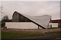
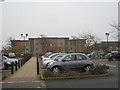
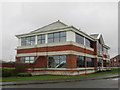
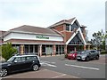
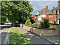
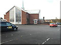
Photos of LN2 4TL


Area Information
LN2 4TL is a compact residential postcode area in England, covering 5,416 square metres and home to 1,686 residents. Its population density of 311,282 people per square kilometre reflects a tightly knit, established community. This small cluster of homes is characterised by a mature demographic, with a median age of 47 and most residents falling within the 30–64 age range. Daily life here is shaped by proximity to local amenities, with nearby schools, retail hubs, and transport links. The area’s small size means it is likely integrated into surrounding neighbourhoods, offering a balance between residential tranquillity and access to essential services. While the population is relatively stable, the high density suggests a mix of long-term residents and those seeking proximity to Lincoln’s urban amenities. For buyers, this area presents a focused microcosm of suburban living, with homes primarily in private ownership and a strong emphasis on community cohesion.
- Area Type
- Postcode
- Area Size
- 5416 m²
- Population
- 1686
- Population Density
- 2778 people/km²
The property market in LN2 4TL is defined by a 49% home ownership rate, indicating that nearly half of properties are rented. This suggests a mix of owner-occupied homes and rental stock, though the exact proportion of rental properties is not specified. The area is primarily composed of houses, which may appeal to families seeking more space than flats or apartments. Given the small size of the postcode and high population density, the housing stock is likely limited, with buyers potentially needing to look beyond LN2 4TL for additional options. The compact nature of the area may also mean that property values are influenced by proximity to nearby amenities such as schools, retail, and transport links. For buyers, this area offers a focused selection of homes, with a strong emphasis on private ownership but also a notable rental market.
House Prices in LN2 4TL
Showing 7 properties
| Address | Type | Beds | Baths | Last Sale Price | Last Sale Date | |
|---|---|---|---|---|---|---|
| 4 Stone Bridge, Lincoln, LN2 4TL | Detached | 3 | 1 | £239,950 | Sep 2022 | |
| 5 Stone Bridge, Lincoln, LN2 4TL | house | - | - | £264,950 | Jun 2022 | |
| 1 Stone Bridge, Lincoln, LN2 4TL | house | - | - | - | - | |
| 2 Stone Bridge, Lincoln, LN2 4TL | house | - | - | - | - | |
| 8 Stone Bridge, Lincoln, LN2 4TL | house | - | - | - | - | |
| 6 Stone Bridge, Lincoln, LN2 4TL | house | - | - | - | - | |
| 3 Stone Bridge, Lincoln, LN2 4TL | house | - | - | - | - |
Energy Efficiency in LN2 4TL
Living in LN2 4TL offers access to a range of amenities within practical reach. Retail options include major stores such as Waitrose Lincoln, Iceland Nettleham, and Asda Lincoln, providing convenience for grocery shopping and daily essentials. The area’s rail connections to Lincoln Central, Hykeham, and Saxilby stations enable easy travel to nearby towns and cities, while nearby RAF Scampton and RAF Waddington airports cater to those requiring air travel. Though no parks or leisure facilities are explicitly listed, the proximity to Lincoln’s urban core likely means residents can access green spaces, cafes, and cultural venues in the surrounding area. The compact nature of the postcode ensures that amenities are not distant, supporting a lifestyle that balances convenience with the potential for community interaction in nearby hubs.
Amenities
Schools
Residents of LN2 4TL have access to multiple primary schools within proximity, including Lincoln Ermine Community Infant School, Our Lady of Lincoln Catholic Primary School, and Ermine Primary School (listed twice in the data). These institutions cater to younger children, with several options available for families. The presence of multiple primary schools suggests a well-served educational environment for young learners, though no secondary schools are mentioned. The variety of primary schools may allow parents to choose between different educational approaches, such as state-run and Catholic institutions. However, the exact Ofsted ratings for these schools are not provided, so prospective families should conduct further research to assess quality. The concentration of schools in the area supports a family-friendly dynamic, with education being a key consideration for buyers.
| Rank | School | Type | Entry gender | Ages |
|---|
Explore more schools in this area
Go to Schools tabDemographics
The community in LN2 4TL is predominantly composed of adults aged 30–64, with a median age of 47. Home ownership stands at 49%, indicating a mix of owner-occupied properties and rental units. The area is largely composed of houses, reflecting a traditional residential layout. The predominant ethnic group is White, with no specific data provided on other demographics. The population density of 311,282 per square kilometre is exceptionally high, suggesting closely packed housing and a reliance on shared community spaces. This density may influence the character of daily life, with limited private outdoor space but strong social connectivity. While no deprivation data is provided, the high population density and age profile suggest a stable, middle-aged population with established routines and local ties.
Household Size
Accommodation Type
Tenure
Ethnic Group
Religion
Household Composition
Age
Household Deprivation
NS-SEC
Explore more demographic insights in this area
Go to Demographics tabPlanning
Planning Constraints
- Flood RiskPremium
- Ramsar Wetland SitesPremium
- Area of Outstanding Natural BeautyPremium
- Protected Nature ReservePremium
- Protected WoodlandPremium