Area Overview for LN2 4RT
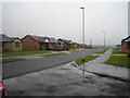
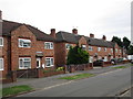
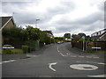
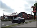
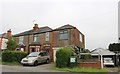
Photos of LN2 4RT


Area Information
LN2 4RT is a compact residential cluster in England, spanning just 1.4 hectares and home to 2561 people. Its high population density—178,669 people per square kilometre—means this area is densely populated yet small in physical size. The community is defined by its proximity to essential services, with two railway stations—Lincoln Central and Hykeham—offering connections to nearby towns. Nearby, supermarkets like Lidl Deacon Road and Aldi St provide daily shopping convenience. The area’s character is shaped by its mix of houses and practical infrastructure, catering to a population where adults aged 30–64 form the majority. Living here means navigating a tight-knit, high-density environment with easy access to transport and retail, though the small footprint means every amenity is within close reach. The area’s appeal lies in its balance of accessibility and residential simplicity, though its size limits expansion or sprawl.
- Area Type
- Postcode
- Area Size
- 1.4 hectares
- Population
- 2561
- Population Density
- 4798 people/km²
LN2 4RT is predominantly an owner-occupied area, with 66% of homes owned by residents rather than rented. The accommodation type is primarily houses, which is unusual for a high-density postcode but may reflect smaller, multi-generational properties. This suggests a market focused on family homes rather than rental properties, which could limit availability for buyers seeking investment opportunities. The small area size—just 1.4 hectares—means the housing stock is limited, and the immediate surroundings may offer more options. For buyers, this implies a competitive market with a focus on long-term ownership rather than short-term rental yields.
House Prices in LN2 4RT
Showing 34 properties
| Address | Type | Beds | Baths | Last Sale Price | Last Sale Date | |
|---|---|---|---|---|---|---|
| 9 Neile Close, Lincoln, LN2 4RT | house | - | - | £100,000 | Apr 2025 | |
| 33 Neile Close, Lincoln, LN2 4RT | Detached | 3 | 1 | £185,000 | Mar 2025 | |
| 6 Neile Close, Lincoln, LN2 4RT | Terraced | 2 | 1 | £140,000 | Jul 2022 | |
| 3 Neile Close, Lincoln, LN2 4RT | Terraced | 3 | 1 | £171,000 | Aug 2021 | |
| 20 Neile Close, Lincoln, LN2 4RT | Bungalow | - | - | £166,500 | Aug 2020 | |
| 43 Neile Close, Lincoln, LN2 4RT | Detached | 4 | 1 | £239,500 | Feb 2020 | |
| 12 Neile Close, Lincoln, LN2 4RT | Semi-detached | 3 | 1 | £152,500 | Sep 2019 | |
| 2 Neile Close, Lincoln, LN2 4RT | Bungalow | - | - | £129,950 | Oct 2018 | |
| 15 Neile Close, Lincoln, LN2 4RT | Semi-detached | 1 | 1 | £108,000 | Aug 2018 | |
| 13 Neile Close, Lincoln, LN2 4RT | Terraced | 1 | 1 | £93,000 | Apr 2017 |
Energy Efficiency in LN2 4RT
Residents of LN2 4RT have access to a range of nearby amenities. The area is served by five retail outlets, including the Lincolnshire Co-operative Co, Lidl Deacon Road, and Aldi St, ensuring daily shopping needs are met. Two railway stations—Lincoln Central and Hykeham—offer connections to larger towns, while nearby RAF Scampton and RAF Waddington provide proximity to military infrastructure. Though the area is small, these amenities contribute to a practical, convenience-driven lifestyle. The compact nature of LN2 4RT means residents can reach essential services on foot or by short drive, fostering a sense of accessibility.
Amenities
Schools
| Rank | School | Type | Entry gender | Ages |
|---|
Explore more schools in this area
Go to Schools tabDemographics
The population of LN2 4RT has a median age of 47, with the largest age group being adults aged 30–64. This suggests a community of established professionals and families, rather than students or retirees. Home ownership is high at 66%, indicating a stable, long-term resident base. The predominant accommodation type is houses, which aligns with the area’s higher population density—178,669 people per square kilometre—suggesting compact, multi-generational living units. The predominant ethnic group is White, though no specific diversity statistics are provided. The age profile and ownership rates imply a mature, settled population with limited turnover, which can influence local services and community dynamics.
Household Size
Accommodation Type
Tenure
Ethnic Group
Religion
Household Composition
Age
Household Deprivation
NS-SEC
Explore more demographic insights in this area
Go to Demographics tabPlanning
Planning Constraints
- Flood RiskPremium
- Ramsar Wetland SitesPremium
- Area of Outstanding Natural BeautyPremium
- Protected Nature ReservePremium
- Protected WoodlandPremium