Area Overview for LN2 4PR
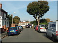
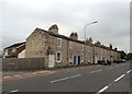
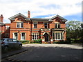
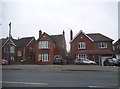
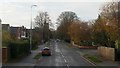
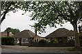
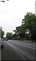
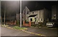
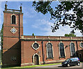
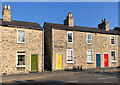
Photos of LN2 4PR
Area Information
Living in LN2 4PR means being part of a tightly knit residential cluster in England, where 1,406 residents occupy just 3,577 square metres. This high population density creates a compact, community-focused environment, ideal for those seeking proximity to essential services. The area’s demographic profile skews towards adults aged 30–64, with a median age of 47, suggesting a stable, mature population. Daily life here is shaped by proximity to schools, retail, and transport links, all within practical reach. The presence of multiple primary schools and a mix of retail outlets, including Tesco Lincoln and Aldi, ensures convenience for families and commuters. While the area is small, its strategic location near Lincoln Central Railway Station and nearby airports like RAF Scampton and RAF Waddington adds to its appeal for those balancing local living with regional connectivity. LN2 4PR is not a sprawling suburb but a focused, functional space where community ties and accessibility define the rhythm of everyday life.
- Area Type
- Postcode
- Area Size
- 3577 m²
- Population
- 1406
- Population Density
- 4598 people/km²
The property market in LN2 4PR is characterised by a 59% home ownership rate, with houses forming the predominant accommodation type. This suggests a market skewed towards owner-occupied properties rather than a high proportion of rentals, though the exact rental dynamics are not quantified. Given the area’s small size and high population density, the housing stock is likely to be tightly packed, with limited scope for new developments. The prevalence of houses may indicate a preference for traditional, family-friendly homes, which could appeal to buyers seeking stability. However, the compact nature of the area means that property availability is limited, and buyers may need to consider nearby zones for more options. For those prioritising ownership, LN2 4PR offers a mix of established homes, but the small footprint of the postcode means that proximity to amenities and transport is a key selling point.
House Prices in LN2 4PR
Showing 8 properties
| Address | Type | Beds | Baths | Last Sale Price | Last Sale Date | |
|---|---|---|---|---|---|---|
| 147 Wragby Road, Lincoln, LN2 4PR | Detached | 3 | 1 | £150,000 | Jul 2025 | |
| 153 Wragby Road, Lincoln, LN2 4PR | Terraced | 3 | 2 | £190,000 | Nov 2022 | |
| 151 Wragby Road, Lincoln, LN2 4PR | Semi-detached | 3 | 1 | £199,500 | Feb 2019 | |
| 149 Wragby Road, Lincoln, LN2 4PR | house | - | - | £89,950 | Oct 2009 | |
| 159 Wragby Road, Lincoln, LN2 4PR | Semi-detached | - | - | £100,000 | May 2006 | |
| 155 Wragby Road, Lincoln, LN2 4PR | house | - | - | - | - | |
| 161 Wragby Road, Lincoln, LN2 4PR | Semi-detached | - | - | - | - | |
| 157 Wragby Road, Lincoln, LN2 4PR | Terraced | - | - | - | - |
Energy Efficiency in LN2 4PR
Residents of LN2 4PR enjoy a lifestyle shaped by its proximity to essential amenities. The area’s retail offerings include major chains such as Tesco Lincoln, Aldi St, and Lidl Deacon Road, ensuring convenient access to groceries and daily essentials. The presence of Lincoln Central Railway Station and Hykeham Railway Station facilitates easy travel to nearby towns and cities, while nearby airports like RAF Scampton and RAF Waddington provide regional and international connectivity. Though the data does not mention parks or leisure facilities, the high population density suggests that public spaces may be limited, requiring residents to travel slightly further for recreational activities. Nonetheless, the practical reach of shops, transport, and airports contributes to a lifestyle that balances convenience with the constraints of a small, densely populated area.
Amenities
Schools
Residents of LN2 4PR have access to a range of primary schools, including The Lincoln St Giles Nursery School, Lincoln St Gile’s Infant School, Lincoln Christ’s Hospital School, and The Chad Varah Primary School. Notably, Lincoln Christ’s Hospital School is also an academy with an Ofsted rating of ‘good’, indicating a higher standard of education. The presence of both nursery and primary schools ensures that families at all early education stages are catered for, reducing the need for long commutes. The variety of school types—state-funded and academy—offers parents choice, though the data does not specify the catchment areas or pupil performance metrics. For families prioritising education quality, the ‘good’ rating at Lincoln Christ’s Hospital School may be a key consideration. The proximity of these schools to homes in LN2 4PR enhances the area’s appeal for families seeking convenient, well-served educational options.
| Rank | School | Type | Entry gender | Ages |
|---|
Explore more schools in this area
Go to Schools tabDemographics
The community in LN2 4PR is predominantly composed of adults aged 30–64, with a median age of 47. This suggests a population skewed towards middle-aged individuals, likely with established careers and family commitments. Home ownership rates stand at 59%, indicating a mix of owner-occupied properties and rental units, though the exact proportion of rentals is not specified. The area’s accommodation is primarily houses, which, combined with the high population density of 393,058 people per square kilometre, implies a compact, possibly multi-generational living arrangement. The predominant ethnic group is White, though no further breakdown of diversity is provided. The high density and mature age profile suggest a stable, low-turnover community, where residents are likely to have long-term ties to the area. This demographic structure may influence local services and amenities, tailored to the needs of an established population rather than transient or younger demographics.
Household Size
Accommodation Type
Tenure
Ethnic Group
Religion
Household Composition
Age
Household Deprivation
NS-SEC
Explore more demographic insights in this area
Go to Demographics tabPlanning
Planning Constraints
- Flood RiskPremium
- Ramsar Wetland SitesPremium
- Area of Outstanding Natural BeautyPremium
- Protected Nature ReservePremium
- Protected WoodlandPremium