Area Overview for LN2 4LX
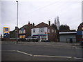
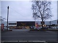
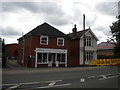
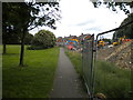
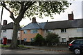
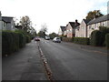
Photos of LN2 4LX

Area Information
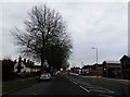
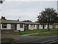
LN2 4LX is a compact residential postcode in England, covering just 1.2 hectares and home to 1,406 residents. Its high population density—113,735 people per square kilometre—reflects a tightly knit community, where proximity to neighbours is a defining feature. The area is predominantly occupied by adults aged 30–64, with a median age of 47, suggesting a mature, stable population. Most residents own their homes, with 59% of properties in private ownership, and the majority are houses rather than flats. This mix of demographics and housing types creates a balanced, family-oriented environment. Daily life here is shaped by the area’s small size, with amenities and services within walking distance. The presence of nearby schools, retail outlets, and transport links adds to its practicality. While the area lacks natural landscapes or protected sites, its strategic location near Lincoln and surrounding towns offers access to broader opportunities. For those seeking a close-knit, functional community with a focus on stability, LN2 4LX provides a straightforward, no-frills living experience.
- Area Type
- Postcode
- Area Size
- 1.2 hectares
- Population
- 1406
- Population Density
- 4598 people/km²
The property market in LN2 4LX is dominated by owner-occupied homes, with 59% of properties in private hands. This suggests a stable, long-term resident base rather than a transient rental market. The accommodation is predominantly houses, which is unusual for a small postcode area but may indicate a focus on family homes or larger properties. Given the high population density and limited land area, the housing stock is likely to be tightly packed, with little scope for expansion. Buyers should consider that the area’s small size means properties are closely spaced, and the immediate surroundings may offer limited additional space. The high home ownership rate also implies a steady demand for properties, though the market is likely to be niche, catering to those prioritising proximity to services and transport over expansive living areas.
House Prices in LN2 4LX
Showing 32 properties
| Address | Type | Beds | Baths | Last Sale Price | Last Sale Date | |
|---|---|---|---|---|---|---|
| 17 Scott Gardens, Lincoln, LN2 4LX | Detached | 3 | 1 | £171,000 | Oct 2025 | |
| 2 Scott Gardens, Lincoln, LN2 4LX | house | - | - | £127,000 | Jul 2022 | |
| 20 Scott Gardens, Lincoln, LN2 4LX | house | - | - | £150,000 | Feb 2022 | |
| 12 Scott Gardens, Lincoln, LN2 4LX | Terraced | 3 | 2 | £140,000 | Nov 2019 | |
| 15 Scott Gardens, Lincoln, LN2 4LX | Terraced | 3 | - | £95,000 | Sep 2017 | |
| 1 Scott Gardens, Lincoln, LN2 4LX | Semi-detached | 3 | 1 | £118,000 | Aug 2016 | |
| 26 Scott Gardens, Lincoln, LN2 4LX | Terraced | 3 | 1 | £85,000 | Nov 2013 | |
| 18 Scott Gardens, Lincoln, LN2 4LX | house | - | - | £74,950 | May 2009 | |
| 10 Scott Gardens, Lincoln, LN2 4LX | Terraced | 3 | 1 | £100,000 | Jun 2008 | |
| 16 Scott Gardens, Lincoln, LN2 4LX | house | - | - | £66,000 | Dec 2003 |
Energy Efficiency in LN2 4LX
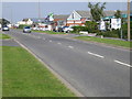
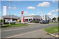
Daily life in LN2 4LX is shaped by its proximity to essential amenities. Retail options include Aldi, Lidl, and Tesco Lincoln, providing convenient access to groceries and household goods. The area’s rail connections—Lincoln Central and Hykeham stations—offer straightforward links to nearby towns and cities, while nearby airports cater to those needing air travel. Although the area is small, its practical reach includes these services, reducing the need for long journeys. The absence of parks or leisure facilities in the data means outdoor recreation may require travel, but the compact nature of the area ensures that shops, transport, and services are within easy reach. This focus on accessibility and functionality makes LN2 4LX appealing to those prioritising convenience over expansive leisure options.
Amenities
Schools
LN2 4LX is served by a range of educational institutions, including nurseries and primary schools. The Lincoln St Giles Nursery School provides early education, while Lincoln St Gile’s Infant School and Lincoln Christ’s Hospital School cater to younger primary students. The Chad Varah Primary School adds to the cluster of primary options. Notably, Lincoln Christ’s Hospital School is also an academy with a ‘good’ Ofsted rating, offering a structured educational environment. This mix of school types ensures families have choices for different stages of education, from nursery through to primary years. The presence of multiple schools within walking distance suggests a focus on accessibility for parents and children, reducing the need for long commutes. However, the absence of secondary schools in the data means further education options may require travel to nearby towns.
| Rank | School | Type | Entry gender | Ages |
|---|
Explore more schools in this area
Go to Schools tabDemographics
The community in LN2 4LX is characterised by a median age of 47, with the largest age group being adults aged 30–64. This suggests a population that is largely in their prime working and family-raising years. Home ownership is high at 59%, indicating a preference for long-term residency over rental properties. The accommodation is predominantly houses, which may reflect a desire for space and privacy within the area’s small footprint. The predominant ethnic group is White, with no data provided on other demographics. The population density of 113,735 people per square kilometre is exceptionally high, meaning residents live in close proximity to one another. This density likely fosters a strong sense of community but may also mean limited private outdoor space. The absence of specific data on deprivation or diversity means the area’s social dynamics are understood primarily through its age profile and ownership patterns.
Household Size
Accommodation Type
Tenure
Ethnic Group
Religion
Household Composition
Age
Household Deprivation
NS-SEC
Explore more demographic insights in this area
Go to Demographics tabPlanning
Planning Constraints
- Flood RiskPremium
- Ramsar Wetland SitesPremium
- Area of Outstanding Natural BeautyPremium
- Protected Nature ReservePremium
- Protected WoodlandPremium