Area Overview for LN2 4HA
Photos of LN2 4HA


Area Information
Living in LN2 4HA means being part of a compact, densely populated residential cluster in England. The area covers just 1.0 hectare, yet it hosts 1,554 residents, creating a high population density of 153,328 people per square kilometre. This small postcode area is defined by its proximity to essential amenities, including retail hubs like Asda Lincoln and Waitrose Lincoln, and key transport links such as Lincoln Central Railway Station. Daily life here is shaped by a balance of urban convenience and a relatively low risk of natural hazards, with no flood risk or protected natural sites nearby. The community is predominantly composed of adults aged 30–64, suggesting a mix of established families and professionals. While the area’s size limits expansion, its strategic location near multiple railway stations and airports, including RAF Scampton, offers connectivity to broader regional networks. For those seeking a compact, amenity-rich environment with straightforward access to transport, LN2 4HA presents a focused, practical living option.
- Area Type
- Postcode
- Area Size
- 1.0 hectares
- Population
- 1554
- Population Density
- 7000 people/km²
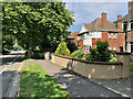
The property market in LN2 4HA is characterised by a low home ownership rate of 17%, suggesting that most residents rent their homes rather than own them. The accommodation type is predominantly houses, which contrasts with the high population density of the area. This implies that properties are likely smaller or multi-occupied to accommodate the 1,554 residents within a 1.0-hectare footprint. The limited size of the postcode area means the housing stock is constrained, potentially leading to competition for available properties. For buyers, this small area may not offer a wide range of options, but its proximity to amenities such as Asda Lincoln and Lincoln Central Railway Station could be a draw. The rental market may dominate, with houses serving as primary dwellings for families or professionals seeking stability in a compact, well-connected environment.
House Prices in LN2 4HA
Showing 40 properties
| Address | Type | Beds | Baths | Last Sale Price | Last Sale Date | |
|---|---|---|---|---|---|---|
| 108 Browning Drive, Lincoln, LN2 4HA | house | - | - | £74,950 | Jan 2016 | |
| 76 Browning Drive, Lincoln, LN2 4HA | Terraced | 2 | 1 | £27,250 | May 2001 | |
| 96 Browning Drive, Lincoln, LN2 4HA | house | - | - | £16,200 | Jul 1996 | |
| 130 Browning Drive, Lincoln, LN2 4HA | Terraced | - | - | - | - | |
| 128 Browning Drive, Lincoln, LN2 4HA | Terraced | - | - | - | - | |
| 120 Browning Drive, Lincoln, LN2 4HA | house | - | - | - | - | |
| 124 Browning Drive, Lincoln, LN2 4HA | house | - | - | - | - | |
| 122 Browning Drive, Lincoln, LN2 4HA | Terraced | - | - | - | - | |
| 64 Browning Drive, Lincoln, LN2 4HA | house | - | - | - | - | |
| 66 Browning Drive, Lincoln, LN2 4HA | house | - | - | - | - |
Energy Efficiency in LN2 4HA
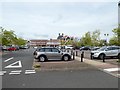
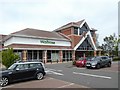
Daily life in LN2 4HA is shaped by its proximity to a range of amenities. Retail options include major supermarkets such as Asda Lincoln, Iceland Nettleham, and Waitrose Lincoln, ensuring easy access to groceries and household essentials. The area’s railway stations—Lincoln Central, Hykeham, and Saxilby—provide convenient links to urban centres and beyond, while nearby airports like RAF Scampton and RAF Waddington offer additional travel options. Though the area is small, its amenities reflect a focus on practicality, with shopping and transport needs met within short distances. The lack of detailed information on leisure or green spaces means the character of the area is defined by its functional, urban-centric offerings. Residents benefit from a compact, efficient environment where essentials are readily available, though the absence of parks or recreational facilities may require trips to nearby neighbourhoods.
Amenities
Schools
Residents of LN2 4HA have access to two notable educational institutions. Lincoln Myle Cross Junior School is a primary school, providing early education for younger children. Springwell Alternative Academy Lincoln is categorised as an "other" school, which may indicate a specialist or alternative educational approach. While no Ofsted ratings are provided, the presence of both a primary school and a secondary-level institution suggests a range of educational options for families. The mix of school types could cater to diverse needs, such as mainstream education or alternative learning paths. For parents, this combination may offer flexibility, though the small area’s size means schools are likely within walking distance or a short journey. The absence of further details on school performance means prospective residents should investigate additional metrics independently.
| Rank | School | Type | Entry gender | Ages |
|---|
Explore more schools in this area
Go to Schools tabDemographics
The population of LN2 4HA is 1,554, with a median age of 47 and a majority of residents falling within the 30–64 age range. This suggests a community skewed towards middle-aged adults, likely including families and professionals. Home ownership is low at 17%, indicating a rental-dominated market, though the accommodation type is primarily houses rather than flats. The predominant ethnic group is White, reflecting a homogenous demographic profile. The high population density—153,328 people per square kilometre—means living spaces are closely packed, which could influence privacy and noise levels. While no specific deprivation data is provided, the low home ownership rate may correlate with economic dynamics such as affordability challenges or a transient population. This demographic structure implies a stable, mature community with established routines, but potential limitations in housing diversity or generational mix.
Household Size
Accommodation Type
Tenure
Ethnic Group
Religion
Household Composition
Age
Household Deprivation
NS-SEC
Explore more demographic insights in this area
Go to Demographics tabPlanning
Planning Constraints
- Flood RiskPremium
- Ramsar Wetland SitesPremium
- Area of Outstanding Natural BeautyPremium
- Protected Nature ReservePremium
- Protected WoodlandPremium