Area Overview for LN2 4DQ
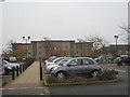
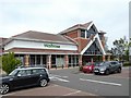
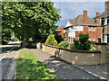
Photos of LN2 4DQ


Area Information
LN2 4DQ is a small residential cluster in England, compact yet densely populated with 1,295 residents spread over 8,479 square metres. This area is defined by its proximity to key transport links and retail hubs, making it a practical choice for those seeking convenience without sacrificing space. The community is predominantly composed of adults aged 30–64, reflecting a mature demographic with established roots. Daily life here is shaped by the balance between urban accessibility and a relatively quiet residential environment. Nearby, the Lincoln Central Railway Station offers connections to major cities, while RAF Scampton and RAF Waddington provide proximity to military infrastructure. The area’s high population density—152,726 people per square kilometre—means it is a tightly knit community, where social interactions are frequent and local amenities are within easy reach. For buyers, this postcode represents a blend of practicality and strategic location, ideal for those prioritising connectivity to retail, transport, and employment opportunities without venturing far from home.
- Area Type
- Postcode
- Area Size
- 8479 m²
- Population
- 1295
- Population Density
- 5723 people/km²
LN2 4DQ is a predominantly owner-occupied area, with 50% of residents living in homes they own. The housing stock consists mainly of houses, with no indication of flats or other property types. This suggests a traditional, family-oriented market where properties are likely to be larger and more established than in newer developments. The small area size and high population density imply that the housing stock is fully occupied, with limited scope for new builds or conversions. For buyers, this means competition for available properties is likely to be strong, particularly for homes in good condition. The area’s proximity to retail and transport hubs may make it attractive to professionals or commuters, but the lack of newer developments could mean that property values are stable rather than rapidly appreciating. Buyers should consider the potential for long-term holding rather than short-term investment, given the mature demographic and limited housing supply.
House Prices in LN2 4DQ
Showing 18 properties
| Address | Type | Beds | Baths | Last Sale Price | Last Sale Date | |
|---|---|---|---|---|---|---|
| 186 Nettleham Road, Lincoln, LN2 4DQ | Semi-detached | 3 | 1 | £330,000 | Jun 2024 | |
| 192 Nettleham Road, Lincoln, LN2 4DQ | Semi-detached | 3 | 1 | £279,950 | Feb 2023 | |
| 188 Nettleham Road, Lincoln, LN2 4DQ | Semi-detached | 3 | 2 | £325,000 | Oct 2022 | |
| 176 Nettleham Road, Lincoln, LN2 4DQ | house | - | - | £265,000 | Aug 2020 | |
| 172 Nettleham Road, Lincoln, LN2 4DQ | house | - | - | £250,000 | Mar 2020 | |
| 174 Nettleham Road, Lincoln, LN2 4DQ | Semi-detached | 3 | 1 | £275,000 | Sep 2018 | |
| 180 Nettleham Road, Lincoln, LN2 4DQ | Semi-detached | 3 | 1 | £155,000 | Nov 2013 | |
| 194 Nettleham Road, Lincoln, LN2 4DQ | house | 3 | - | £135,250 | May 2011 | |
| 190 Nettleham Road, Lincoln, LN2 4DQ | house | - | - | £140,000 | Oct 2009 | |
| 198 Nettleham Road, Lincoln, LN2 4DQ | Detached | - | - | £219,995 | Aug 2007 |
Energy Efficiency in LN2 4DQ
Living in LN2 4DQ grants access to a range of practical amenities within easy reach. Retail options include major supermarkets such as Waitrose Lincoln, Iceland Nettleham, and Asda Lincoln, ensuring everyday shopping needs are met without long journeys. The area’s rail network, with stations at Lincoln Central, Hykeham, and Saxilby, provides reliable connections to urban centres and beyond. For those interested in aviation, RAF Scampton and RAF Waddington are nearby, though their influence on local life is minimal. The compact nature of the area means that residents can access essential services without needing a car, though the high population density may mean some areas feel crowded during peak times. The presence of established retail and transport hubs contributes to a convenient, if modest, lifestyle, where daily routines are streamlined by proximity to key facilities.
Amenities
Schools
| Rank | School | Type | Entry gender | Ages |
|---|
Explore more schools in this area
Go to Schools tabDemographics
The population of LN2 4DQ is 1,295, with a median age of 47, indicating a community skewed towards middle-aged adults. Over half (50%) of residents own their homes, while the remaining 50% are likely to be renters, suggesting a mix of long-term residents and transient occupants. The area is predominantly composed of houses, with no data on flats or other property types. Ethnically, the population is largely White, with no specific breakdown provided for other groups. The age range of 30–64 years dominates, implying a stable, working-age population with fewer children or elderly residents. This profile suggests a community focused on established careers and family life, with limited demand for schools or childcare facilities. The absence of deprivation data means the area’s quality of life cannot be assessed in terms of economic hardship, but the high home ownership rate and mature demographic suggest a generally stable socioeconomic environment.
Household Size
Accommodation Type
Tenure
Ethnic Group
Religion
Household Composition
Age
Household Deprivation
NS-SEC
Explore more demographic insights in this area
Go to Demographics tabPlanning
Planning Constraints
- Flood RiskPremium
- Ramsar Wetland SitesPremium
- Area of Outstanding Natural BeautyPremium
- Protected Nature ReservePremium
- Protected WoodlandPremium