Area Overview for LN2 4BL
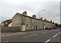
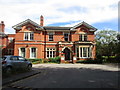
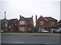
Photos of LN2 4BL


Area Information
LN2 4BL is a compact residential postcode in England, covering just 2.1 hectares and home to 1827 residents. Its high population density—88,836 people per square kilometre—reflects a tightly knit community, though the area’s small size means it is a focused cluster of homes rather than a sprawling suburb. The median age of 47 suggests a mature demographic, with most residents aged between 30 and 64. Daily life here is likely shaped by proximity to local amenities, schools, and transport links. While the area lacks large-scale infrastructure, its proximity to Lincoln and nearby towns offers access to broader services. Living in LN2 4BL suits those prioritising convenience over space, with a balance of residential stability and practical connectivity to nearby towns and cities.
- Area Type
- Postcode
- Area Size
- 2.1 hectares
- Population
- 1827
- Population Density
- 2768 people/km²
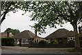
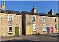
LN2 4BL is a small area with a housing stock primarily composed of houses, rather than flats or apartments. With 56% of properties owned by residents, it is not a rental-heavy market, though the exact proportion of rentals is unspecified. The compact size of the postcode suggests limited housing availability, which may drive competition among buyers. The predominance of houses indicates a focus on family homes, potentially appealing to those seeking traditional property types. However, the area’s small footprint means buyers should consider nearby zones for more options. The mix of owner-occupation and rental properties suggests a balance between long-term residents and those seeking short-term housing solutions.
House Prices in LN2 4BL
Showing 17 properties
| Address | Type | Beds | Baths | Last Sale Price | Last Sale Date | |
|---|---|---|---|---|---|---|
| 31 Mainwaring Road, Lincoln, LN2 4BL | house | - | - | £632,000 | Jun 2022 | |
| 21 Mainwaring Road, Lincoln, LN2 4BL | house | - | - | £600,000 | Jun 2019 | |
| 9 Mainwaring Road, Lincoln, LN2 4BL | house | - | - | £480,000 | Sep 2016 | |
| 12 Mainwaring Road, Lincoln, LN2 4BL | Detached | 4 | 2 | £487,500 | Jun 2015 | |
| 25 Mainwaring Road, Lincoln, LN2 4BL | Detached | 4 | 4 | £378,000 | Nov 2014 | |
| 5 Mainwaring Road, Lincoln, LN2 4BL | house | 2 | - | £495,000 | Mar 2014 | |
| 19 Mainwaring Road, Lincoln, LN2 4BL | house | 4 | - | £500,000 | Nov 2010 | |
| 10 Mainwaring Road, Lincoln, LN2 4BL | Detached | - | - | £580,000 | May 2007 | |
| 23 Mainwaring Road, Lincoln, LN2 4BL | Detached | - | - | £380,000 | Aug 2006 | |
| 29 Mainwaring Road, Lincoln, LN2 4BL | Detached | - | - | £397,500 | Nov 2005 |
Energy Efficiency in LN2 4BL
LN2 4BL’s residents have access to essential amenities within practical reach, including five retail outlets such as Tesco Lincoln, Lincolnshire Co-operative Co, and Aldi St. These shops cater to everyday needs, from groceries to household goods. The area’s rail links—Lincoln Central, Hykeham, and Saxilby stations—provide direct access to nearby towns and cities, enhancing mobility. Nearby airports, RAF Scampton and RAF Waddington, offer additional travel options. While the area’s small size limits large-scale leisure facilities, its proximity to Lincoln ensures access to cultural and recreational opportunities. The mix of retail, transport, and local services creates a convenient, though compact, lifestyle.
Amenities
Schools
Residents of LN2 4BL have access to a range of educational institutions, including The Lincoln St Peter-in-Eastgate Church of England (Controlled) Infants School, which is rated as satisfactory by Ofsted. Independent schools such as St Mary’s School, The Cathedral School, and Stonefield House School offer alternative options for families. The Lincolnshire College of Art and Design, categorised as ‘other’, adds further educational diversity. The presence of both state and independent schools provides flexibility for parents, whether prioritising affordability or specialist education. This mix supports families with varying needs, from early years education to further learning opportunities.
| Rank | School | Type | Entry gender | Ages |
|---|
Explore more schools in this area
Go to Schools tabDemographics
The population of LN2 4BL is predominantly adults aged 30–64, with a median age of 47. Home ownership rates stand at 56%, indicating a mix of owner-occupied properties and rentals. The accommodation type is primarily houses, reflecting a residential character distinct from high-density flats. The predominant ethnic group is White, though specific data on diversity or deprivation is not provided. The high population density—88,836 people per square kilometre—suggests a closely packed community, which may influence local dynamics. For buyers, this demographic profile implies a stable, family-oriented environment with a focus on long-term residency rather than transient populations.
Household Size
Accommodation Type
Tenure
Ethnic Group
Religion
Household Composition
Age
Household Deprivation
NS-SEC
Explore more demographic insights in this area
Go to Demographics tabPlanning
Planning Constraints
- Flood RiskPremium
- Ramsar Wetland SitesPremium
- Area of Outstanding Natural BeautyPremium
- Protected Nature ReservePremium
- Protected WoodlandPremium