Area Overview for LN2 3TE
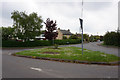
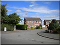
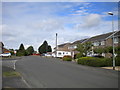
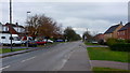
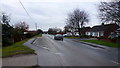
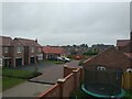
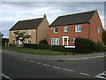
Photos of LN2 3TE


Area Information
LN2 3TE is a small, tightly knit residential area in England, covering 4,327 square metres and home to 1,978 residents. Its compact size and moderate population density of 200 people per square kilometre create a quiet, community-focused environment. The area is defined by its modest scale, with homes predominantly in private ownership and a population skewed toward adults aged 30–64. This demographic suggests a stable, established community with a focus on family living and long-term residency. Daily life here is shaped by proximity to essential services, including a railway station and a nearby airfield, which provide both local and regional connectivity. The area’s low flood risk and absence of environmental constraints such as protected woodlands or AONB designations make it a practical choice for those prioritising safety and planning certainty. While it lacks the density of urban centres, LN2 3TE offers a relaxed, low-maintenance lifestyle with a strong sense of local identity.
- Area Type
- Postcode
- Area Size
- 4327 m²
- Population
- 1978
- Population Density
- 200 people/km²
The property market in LN2 3TE is characterised by a high rate of home ownership, with 78% of properties owned by their residents. This suggests a market where long-term residency and investment are common, rather than a transient rental-focused environment. The accommodation type is exclusively houses, which contrasts with areas where flats or apartments dominate. This housing stock likely appeals to those seeking spacious, private living with garden potential, though the small area size means the inventory of homes is limited. Buyers should consider the proximity to Lincoln Central Railway Station and RAF Scampton, which may influence property values and desirability. The area’s compact nature means opportunities for purchase are restricted to the immediate vicinity, requiring buyers to be selective and proactive in their search.
House Prices in LN2 3TE
Showing 17 properties
| Address | Type | Beds | Baths | Last Sale Price | Last Sale Date | |
|---|---|---|---|---|---|---|
| 115 Rivehall Avenue, Welton, Lincoln, LN2 3TE | house | 3 | 2 | £213,000 | Dec 2025 | |
| 111 Rivehall Avenue, Welton, Lincoln, LN2 3TE | Semi-detached | 3 | 1 | £187,500 | Jan 2024 | |
| 87 Rivehall Avenue, Welton, Lincoln, LN2 3TE | house | - | - | £170,000 | Aug 2021 | |
| 105 Rivehall Avenue, Welton, Lincoln, LN2 3TE | Semi-detached | 2 | 1 | £134,000 | May 2020 | |
| 101 Rivehall Avenue, Welton, Lincoln, LN2 3TE | Semi-detached | 2 | 1 | £135,000 | Sep 2018 | |
| 113 Rivehall Avenue, Welton, Lincoln, LN2 3TE | Semi-detached | 3 | 1 | £187,500 | Jun 2018 | |
| 97 Rivehall Avenue, Welton, Lincoln, LN2 3TE | Semi-detached | 2 | 1 | £132,500 | Oct 2017 | |
| 85 Rivehall Avenue, Welton, Lincoln, LN2 3TE | house | 2 | - | £129,500 | Jun 2016 | |
| 89 Rivehall Avenue, Welton, Lincoln, LN2 3TE | Semi-detached | 2 | 1 | £124,950 | Oct 2015 | |
| 93 Rivehall Avenue, Welton, Lincoln, LN2 3TE | Semi-detached | 2 | 1 | £108,000 | Dec 2011 |
Energy Efficiency in LN2 3TE
Living in LN2 3TE offers access to a mix of practical amenities, including five retail outlets, notably three branches of Lincolnshire Co-operative Co, which provide essential shopping and services. The proximity to Lincoln Central Railway Station enhances connectivity, allowing residents to reach Lincoln’s cultural and commercial centres easily. RAF Scampton, while primarily a military facility, adds a unique character to the area. Though the retail options are limited, the nearby Lincolnshire Co-operative Co ensures basic needs are met. The area’s small footprint means leisure and dining choices are confined to the immediate vicinity, but the railway station offers access to broader options in Lincoln. This blend of local convenience and regional reach shapes a lifestyle that balances simplicity with accessibility.
Amenities
Schools
| Rank | School | Type | Entry gender | Ages |
|---|
Explore more schools in this area
Go to Schools tabDemographics
The population of LN2 3TE is predominantly composed of adults aged 30–64, reflecting a mature, settled community. The median age of 47 indicates a demographic that is largely in its prime working and family-raising years. Home ownership is high, with 78% of residents living in properties they own, suggesting a stable housing market and long-term commitment to the area. The accommodation type is primarily houses, which aligns with the area’s residential character and likely contributes to a more spacious, traditional living environment. The predominant ethnic group is White, and no data on diversity or deprivation is provided, though the population density of 200 per square kilometre implies a balance between privacy and community access. This profile points to a neighbourhood where residents prioritise stability, family-oriented living, and proximity to essential services.
Household Size
Accommodation Type
Tenure
Ethnic Group
Religion
Household Composition
Age
Household Deprivation
NS-SEC
Explore more demographic insights in this area
Go to Demographics tabPlanning
Planning Constraints
- Flood RiskPremium
- Ramsar Wetland SitesPremium
- Area of Outstanding Natural BeautyPremium
- Protected Nature ReservePremium
- Protected WoodlandPremium