Area Overview for LN2 3ST
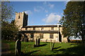
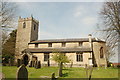
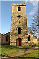
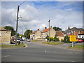
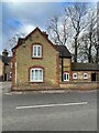
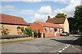
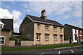
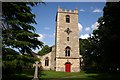
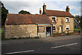
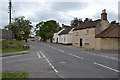
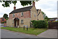
Photos of LN2 3ST

Area Information
LN2 3ST is a small, residential postcode area in England, covering just 2.0 hectares and home to 2550 people. With a population density of 85 people per square kilometre, it is a compact, tightly knit community. The area’s size means it is not sprawling, but its proximity to Lincoln and surrounding infrastructure makes it a practical choice for those seeking a quieter, residential environment. Daily life here is shaped by its demographics: the median age is 47, with most residents falling into the 30-64 age range. This suggests a stable, established community, likely with families and professionals who value a low-key, localised lifestyle. The area is predominantly owner-occupied, with 82% of homes owned by residents, and most properties are houses rather than flats. This mix of characteristics positions LN2 3ST as a place where residents can expect a mix of generational stability and practical living conditions, all within a small, manageable footprint.
- Area Type
- Postcode
- Area Size
- 2.0 hectares
- Population
- 2550
- Population Density
- 85 people/km²
The property market in LN2 3ST is characterised by a high rate of home ownership, with 82% of residents owning their homes. This suggests a stable market where properties are likely to be held long-term rather than frequently sold or rented out. The accommodation type is predominantly houses, which is unusual for smaller postcode areas that often include flats or terraced housing. This mix of ownership and housing type may reflect a community that prioritises private, standalone homes, possibly catering to families or professionals seeking more space. However, the small area size of 2.0 hectares means the housing stock is limited, which could make the local market competitive for buyers. Those considering properties here may need to look beyond the immediate postcode for more options, though the area’s proximity to Lincoln and its transport links could provide broader access to housing choices.
House Prices in LN2 3ST
Showing 30 properties
| Address | Type | Beds | Baths | Last Sale Price | Last Sale Date | |
|---|---|---|---|---|---|---|
| 47 Merleswen, Dunholme, Lincoln, LN2 3ST | Bungalow | 3 | 1 | £235,000 | Feb 2025 | |
| 20 Merleswen, Dunholme, Lincoln, LN2 3ST | Bungalow | 3 | 1 | £233,000 | May 2024 | |
| 51 Merleswen, Dunholme, Lincoln, LN2 3ST | Bungalow | - | - | £320,000 | Nov 2022 | |
| 30 Merleswen, Dunholme, Lincoln, LN2 3ST | Bungalow | 2 | 1 | £188,500 | Oct 2021 | |
| 40 Merleswen, Dunholme, Lincoln, LN2 3ST | Bungalow | - | - | £211,000 | May 2020 | |
| 54 Merleswen, Dunholme, Lincoln, LN2 3ST | Bungalow | 3 | 1 | £190,000 | Sep 2019 | |
| 49 Merleswen, Dunholme, Lincoln, LN2 3ST | Bungalow | - | - | £147,000 | Nov 2017 | |
| 26 Merleswen, Dunholme, Lincoln, LN2 3ST | Bungalow | 2 | 1 | £168,500 | Sep 2015 | |
| 46 Merleswen, Dunholme, Lincoln, LN2 3ST | Bungalow | 2 | 1 | £154,950 | Mar 2015 | |
| 50 Merleswen, Dunholme, Lincoln, LN2 3ST | Detached | 2 | 1 | £132,000 | Nov 2013 |
Energy Efficiency in LN2 3ST
The lifestyle in LN2 3ST is shaped by its proximity to essential amenities. Within practical reach are five retail venues, including three Lincolnshire Co-operative Co outlets, offering everyday shopping and services. The presence of a railway station at Lincoln Central provides access to broader retail, dining, and leisure opportunities in Lincoln, while RAF Scampton offers a unique connection to military and regional travel. Though the area itself is small, its integration with Lincoln’s infrastructure means residents can enjoy a mix of local convenience and city amenities. The absence of major parks or leisure facilities within the postcode suggests that outdoor activities may require travel to nearby green spaces or Lincoln’s urban offerings. Overall, the area supports a modest, practical lifestyle with a focus on accessibility and local retail.
Amenities
Schools
Residents of LN2 3ST have access to a range of educational institutions, though the options are varied in type and quality. Dunholme St Chad’s Church of England Primary School is a state-funded primary school with an Ofsted rating of satisfactory, offering a conventional education for younger children. William Farr CofE Comprehensive School appears twice in the data, once as a primary school and once as an academy with a good Ofsted rating. This duplication may indicate a transition in the school’s status or a mix of educational provision. Acacia Hall Therapeutic Community is an independent school, which may appeal to families seeking alternative or specialist education. The presence of both state and independent schools provides flexibility for families, though the ratings suggest that while some institutions perform well, others may require closer scrutiny. Parents should consider visiting schools to assess their suitability for their child’s needs.
| Rank | School | Type | Entry gender | Ages |
|---|
Explore more schools in this area
Go to Schools tabDemographics
The community in LN2 3ST is defined by its age profile and household structure. With a median age of 47, the area is skewed towards adults in their 30s to 60s, suggesting a population that is largely settled in their careers and family lives. The most common age range, 30-64 years, indicates a mix of middle-aged professionals and families with children. Home ownership is high, at 82%, which aligns with the predominance of houses as the primary accommodation type. This suggests a stable, long-term resident base rather than a transient rental market. The predominant ethnic group is White, though specific diversity figures are not provided. The low population density of 85 people per square kilometre means the area is not densely packed, offering a balance between community cohesion and personal space. For those considering life here, the data points to a mature, established demographic with a focus on homeownership and family-oriented living.
Household Size
Accommodation Type
Tenure
Ethnic Group
Religion
Household Composition
Age
Household Deprivation
NS-SEC
Explore more demographic insights in this area
Go to Demographics tabPlanning
Planning Constraints
- Flood RiskPremium
- Ramsar Wetland SitesPremium
- Area of Outstanding Natural BeautyPremium
- Protected Nature ReservePremium
- Protected WoodlandPremium