Area Overview for LN2 3SG
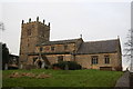
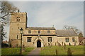
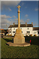
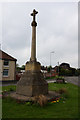
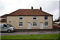
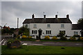
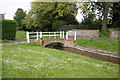
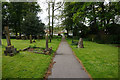
Photos of LN2 3SG
Area Information
Living in LN2 3SG means inhabiting a small, tightly knit residential cluster in England. With a population of 2550 spread over 9818 square metres, the area maintains a low density of 85 people per square kilometre, offering a quiet, uncluttered environment. This postcode is characterised by its modest scale, where daily life unfolds within walking distance of essential services and local amenities. The community here is predominantly composed of adults aged 30–64, reflecting a mature, stable demographic. Home ownership is high at 82%, suggesting a long-term commitment to the area. While LN2 3SG lacks the vibrancy of larger urban centres, its compact size ensures a sense of familiarity and ease of navigation. Residents benefit from proximity to Lincoln Central Railway Station and RAF Scampton, though the area’s charm lies in its simplicity. For those seeking a low-maintenance lifestyle with limited exposure to urban congestion, LN2 3SG provides a practical base. The absence of major environmental constraints, such as protected woodlands or flood zones, further enhances its appeal for buyers prioritising safety and stability.
- Area Type
- Postcode
- Area Size
- 9818 m²
- Population
- 2550
- Population Density
- 85 people/km²
The property market in LN2 3SG is dominated by owner-occupied homes, with 82% of residents living in properties they own. This high rate of home ownership suggests a community of long-term residents rather than a transient rental market. The accommodation type is predominantly houses, which is unusual for areas with higher population densities but aligns with the low population density of 85 people per square kilometre. This implies that the housing stock consists of single-family homes rather than apartments or terraced properties. Given the small size of the area—just 9818 square metres—the number of available properties is limited, which could make the market competitive for buyers. The focus on owner-occupied housing also means that rental options are scarce, potentially limiting flexibility for those seeking short-term accommodation. For buyers, this suggests a niche market where properties are likely to remain in private hands for extended periods, with limited turnover.
House Prices in LN2 3SG
Showing 20 properties
| Address | Type | Beds | Baths | Last Sale Price | Last Sale Date | |
|---|---|---|---|---|---|---|
| 5 Allwood Road, Dunholme, Lincoln, LN2 3SG | Retail | 3 | 1 | £160,000 | Mar 2022 | |
| 22 Allwood Road, Dunholme, Lincoln, LN2 3SG | house | - | - | £130,000 | Jan 2021 | |
| 1 Allwood Road, Dunholme, Lincoln, LN2 3SG | Semi-detached | 3 | 1 | £155,000 | Jul 2018 | |
| 7 Allwood Road, Dunholme, Lincoln, LN2 3SG | Terraced | 3 | 1 | £140,000 | Mar 2018 | |
| 18 Allwood Road, Dunholme, Lincoln, LN2 3SG | Terraced | 3 | - | £119,500 | Oct 2015 | |
| 14 Allwood Road, Dunholme, Lincoln, LN2 3SG | Terraced | - | - | £81,000 | Jan 2004 | |
| 24 Allwood Road, Dunholme, Lincoln, LN2 3SG | Terraced | 3 | 1 | - | - | |
| 26 Allwood Road, Dunholme, Lincoln, LN2 3SG | Bungalow | - | - | - | - | |
| 8 Allwood Road, Dunholme, Lincoln, LN2 3SG | house | - | - | - | - | |
| 16 Allwood Road, Dunholme, Lincoln, LN2 3SG | house | - | - | - | - |
Energy Efficiency in LN2 3SG
The lifestyle in LN2 3SG is shaped by its proximity to a small selection of amenities. The area has five retail outlets, primarily Lincolnshire Co-operative Co stores, which provide basic shopping needs. For those seeking more varied options, the nearest significant retail or leisure facilities would likely be found in nearby towns. The presence of Lincoln Central Railway Station offers access to regional transport, while RAF Scampton may provide employment opportunities or specialist services. However, the area lacks dedicated parks, dining venues, or cultural facilities within its immediate boundaries. The low population density and small size of LN2 3SG mean that residents may need to travel beyond the postcode for a full range of leisure activities. Despite this, the area’s compact nature ensures that essential services are within practical reach, making it suitable for those prioritising simplicity and proximity to local infrastructure over extensive urban amenities.
Amenities
Schools
The schools near LN2 3SG include Dunholme St Chad’s Church of England Primary School, which holds an Ofsted rating of satisfactory, and William Farr CofE Comprehensive School, which operates as both a primary school and an academy with a good Ofsted rating. Acacia Hall Therapeutic Community is an independent school, offering an alternative to state-run institutions. This mix of school types provides families with options, from state-funded primary education to independent alternatives. The presence of an academy with a good rating indicates a strong educational offering for primary-aged children, while the independent school caters to those seeking specialist or therapeutic education. However, the data does not specify the number of secondary schools or higher education institutions in the area, which may be a consideration for families with older children. Overall, the school landscape suggests a focus on primary education, with limited information on secondary provision.
| Rank | School | Type | Entry gender | Ages |
|---|
Explore more schools in this area
Go to Schools tabDemographics
The community in LN2 3SG is predominantly composed of adults aged 30–64, with a median age of 47. This suggests a population that is largely in their prime working years, likely contributing to a steady, stable local economy. Home ownership is exceptionally high at 82%, indicating that most residents are long-term residents rather than renters. The area is primarily composed of houses, which aligns with the demographic profile of older, established households. The predominant ethnic group is White, reflecting a homogenous community with limited diversity. The population density of 85 people per square kilometre is low, which may contribute to a quieter, less crowded living environment. While this data does not provide direct information on deprivation levels, the combination of high home ownership and a mature age profile suggests a community with relatively low economic pressure. However, the limited presence of retail and leisure options within the area may impact the quality of life for those prioritising convenience.
Household Size
Accommodation Type
Tenure
Ethnic Group
Religion
Household Composition
Age
Household Deprivation
NS-SEC
Explore more demographic insights in this area
Go to Demographics tabPlanning
Planning Constraints
- Flood RiskPremium
- Ramsar Wetland SitesPremium
- Area of Outstanding Natural BeautyPremium
- Protected Nature ReservePremium
- Protected WoodlandPremium